MyTopo
Atlanta South Texas US Topo Map
Couldn't load pickup availability
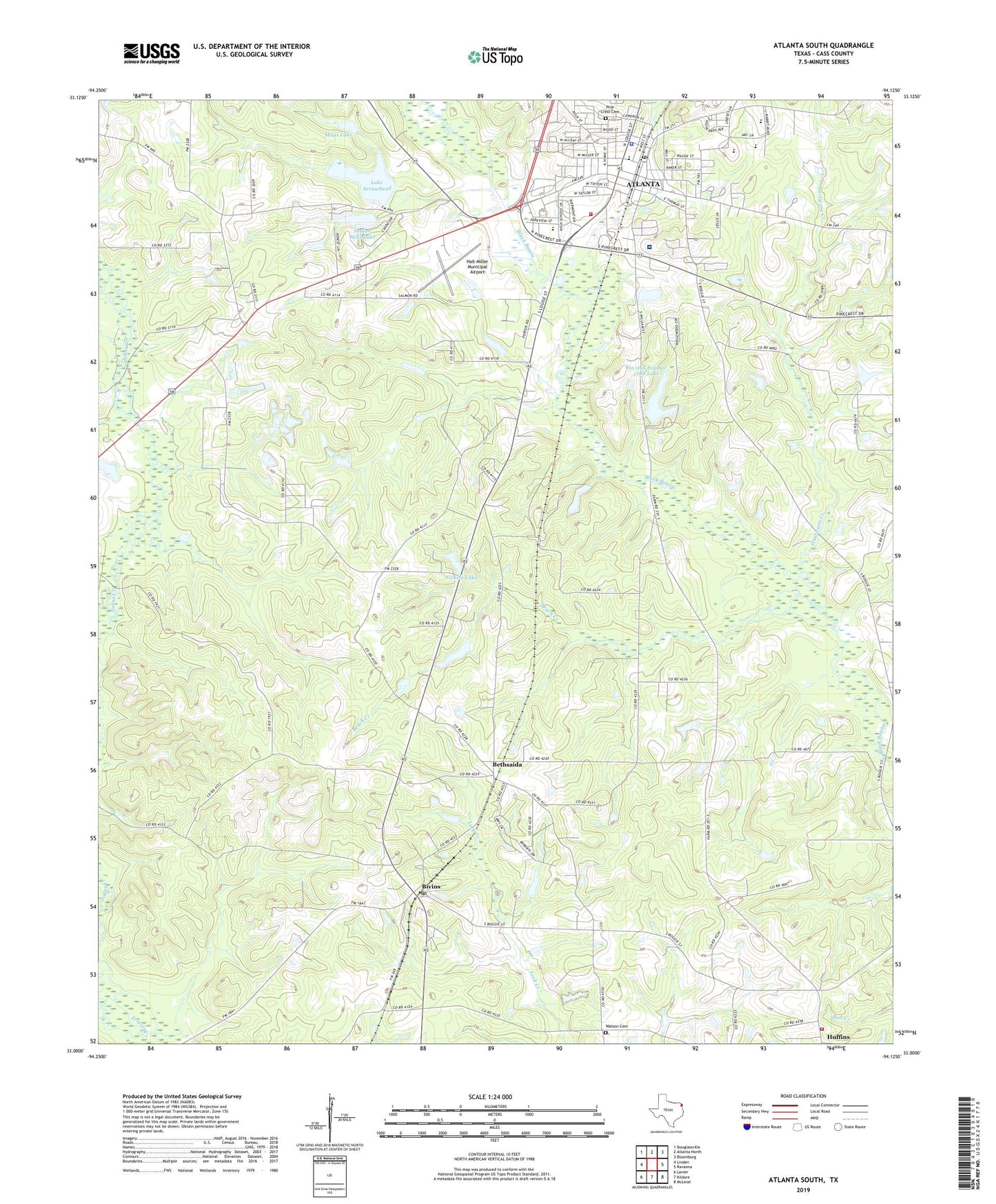
2019 topographic map quadrangle Atlanta South in the state of Texas. Scale: 1:24000. Based on the newly updated USGS 7.5' US Topo map series, this map is in the following counties: Cass. The map contains contour data, water features, and other items you are used to seeing on USGS maps, but also has updated roads and other features. This is the next generation of topographic maps. Printed on high-quality waterproof paper with UV fade-resistant inks.
Quads adjacent to this one:
West: Linden
Northwest: Douglassville
North: Atlanta North
Northeast: Bloomburg
East: Ravanna
Southeast: McLeod
South: Kildare
Southwest: Lanier
Contains the following named places: All Saints Episcopal Church, Atlanta, Atlanta Church of Christ, Atlanta Church of God, Atlanta City Hall, Atlanta Fire Department, Atlanta High School, Atlanta Police Department, Atlanta Post Office, Atlanta Primary School, Beach Creek, Bethsaida, Bivins, Bivins Census Designated Place, Bivins Post Office, Brooks Hospital, Cass County Fire District 1 Huffins Station, Christus Saint Michael Hospital, Church of God, City of Atlanta, Corrective Behavior Center, Fin and Feather Club Dam, Fin and Feather Club Lake, First Assembly of God Church, First Baptist Church, First Church of the Nazarene, First Presbyterian Church, Glad Tidings Assembly of God Church, Hall-Miller Municipal Airport, Hurricane Creek, Indian Hills Dam, Indian Hills Lake, Johns Creek, KALT-AM (Atlanta), KPYN-FM (Atlanta), Lake Arrowhead, Lake Arrowhead Dam, Laws Chapel, Life Tabernacle United Pentecostal Church, Mays Lake, Mays Lake Dam, McNobie Park, Nickels Lake, Nickels Lake Dam, Oak Grove, Pine Crest Cemetery, Seventh Day Adventist Church, Shady Grove Church, Thomas Saint Baptist Church, Watson Cemetery, ZIP Code: 75551