MyTopo
Kildare Texas US Topo Map
Couldn't load pickup availability
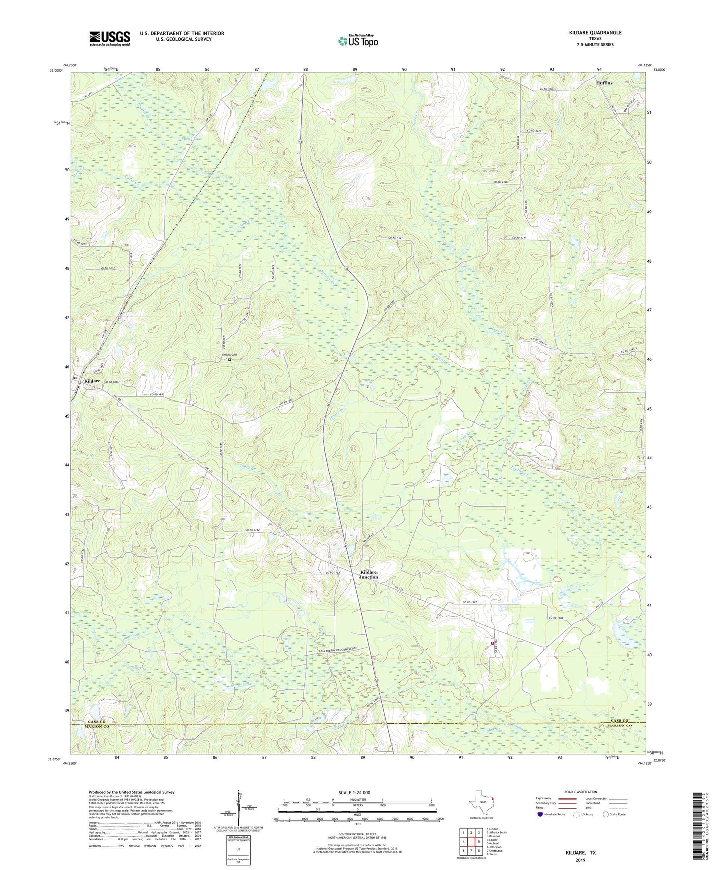
2022 topographic map quadrangle Kildare in the state of Texas. Scale: 1:24000. Based on the newly updated USGS 7.5' US Topo map series, this map is in the following counties: Cass, Marion. The map contains contour data, water features, and other items you are used to seeing on USGS maps, but also has updated roads and other features. This is the next generation of topographic maps. Printed on high-quality waterproof paper with UV fade-resistant inks.
Quads adjacent to this one:
West: Lanier
Northwest: Linden
North: Atlanta South
Northeast: Ravanna
East: McLeod
Southeast: Trees
South: Smithland
Southwest: Jefferson
This map covers the same area as the classic USGS quad with code o32094h2.
Contains the following named places: Bear Creek, Bivins-McLeod Division, Camp Creek, Cass County Fire District 1 Kildare Station, Cole Creek, Corey Branch, Duck Creek, Ferrell Cemetery, Grogan Dam, Grogan Lake, Haynes Oil Field, Huffins, Kildare, Kildare Junction, Kildare Oil Field, Kildare Post Office, Leek Creek, Linden-Kildare Junior High School, Moore Branch, New Zion Church, Saint John Church, Saint Paul Church, Spear Lake, Timber Branch, ZIP Codes: 75555, 75562