MyTopo
Avinger Texas US Topo Map
Couldn't load pickup availability
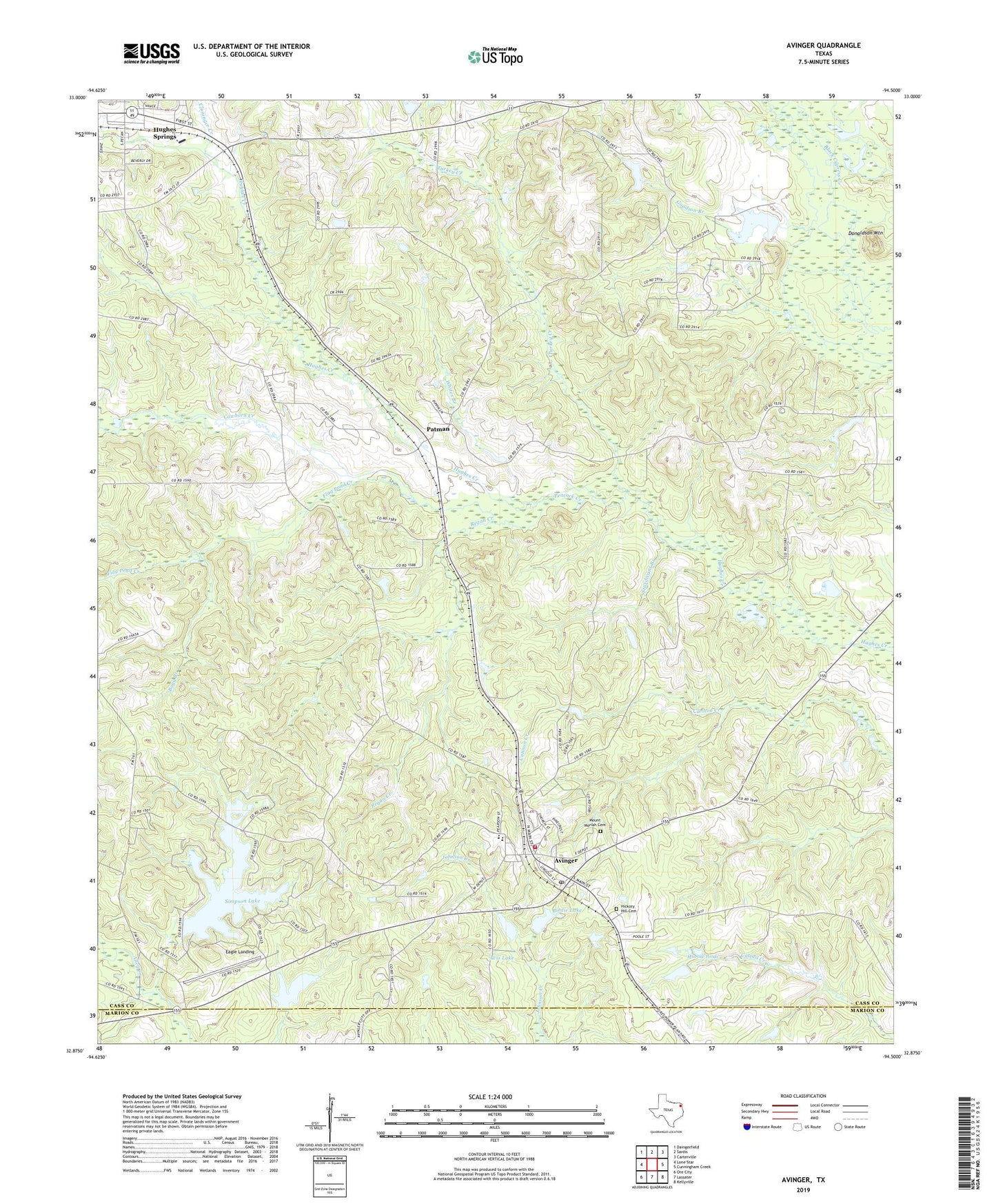
2019 topographic map quadrangle Avinger in the state of Texas. Scale: 1:24000. Based on the newly updated USGS 7.5' US Topo map series, this map is in the following counties: Cass, Marion. The map contains contour data, water features, and other items you are used to seeing on USGS maps, but also has updated roads and other features. This is the next generation of topographic maps. Printed on high-quality waterproof paper with UV fade-resistant inks.
Quads adjacent to this one:
West: Lone Star
Northwest: Daingerfield
North: Sardis
Northeast: Carterville
East: Cunningham Creek
Southeast: Kellyville
South: Lassater
Southwest: Ore City
Contains the following named places: Avinger, Avinger Post Office, Avinger Volunteer Fire Department, Avis Dam, Avis Lake, Birdie Dam, Birdie Lake, Bogg Branch, Cawhorn Creek, Cloninger Creek, Donaldson Mountain, Duncan School, Eagle Landing, Flag Pond Creek, Goodson Branch, Hickory Hill Cemetery, Hughes Springs-Avinger Division, King Branch, Love, Minnow Ponds, Mount Moriah Cemetery, Patman, Peacock Creek, Pruitt Lake, Pruitt Lake Church, Regan Creek, Rhyne Dam, Rhyne Lake, Simpson Lake, Simpson Lake Dam, Sturdivant Branch, Town of Avinger, Traylor School, Turkey Creek, Union Hill Church, Whites Branch