MyTopo
Bandera Mesa North Texas US Topo Map
Couldn't load pickup availability
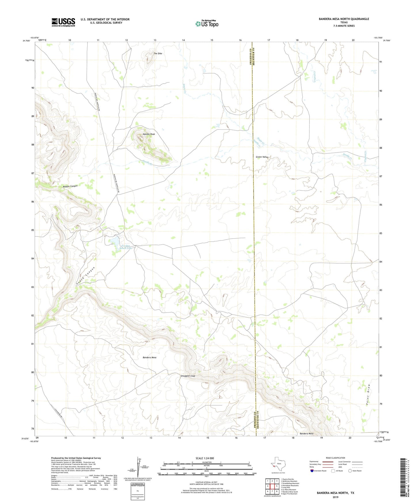
2022 topographic map quadrangle Bandera Mesa North in the state of Texas. Scale: 1:24000. Based on the newly updated USGS 7.5' US Topo map series, this map is in the following counties: Presidio, Brewster. The map contains contour data, water features, and other items you are used to seeing on USGS maps, but also has updated roads and other features. This is the next generation of topographic maps. Printed on high-quality waterproof paper with UV fade-resistant inks.
Quads adjacent to this one:
West: Horseshoe Mountains
Northwest: Puerto Potrillo
North: McKinney Mountain
Northeast: Straddlebug Mountain
East: Long Hills
Southeast: Agua Fria Mountain
South: Bandera Mesa South
Southwest: La Mota Mountain
This map covers the same area as the classic USGS quad with code o29103f7.
Contains the following named places: Cotters Ranch, Dogie Creek, Fowlkes Ranch Lake, Fowlkes Ranch Lake Dam, Middle Canyon, Needle Creek, Needle Peak, Rooney Ranch, Seminole Trail, Smugglers Gap, South Canyon, The Dike