MyTopo
Bassett Texas US Topo Map
Couldn't load pickup availability
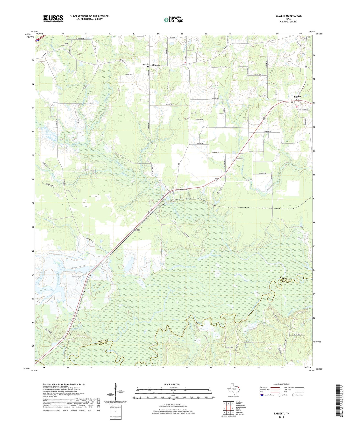
2022 topographic map quadrangle Bassett in the state of Texas. Scale: 1:24000. Based on the newly updated USGS 7.5' US Topo map series, this map is in the following counties: Bowie, Cass. The map contains contour data, water features, and other items you are used to seeing on USGS maps, but also has updated roads and other features. This is the next generation of topographic maps. Printed on high-quality waterproof paper with UV fade-resistant inks.
Quads adjacent to this one:
West: Dalby Springs
Northwest: Hodgson
North: Malta
Northeast: New Boston
East: Corley
Southeast: Bryans Mill
South: Marietta
Southwest: Naples
This map covers the same area as the classic USGS quad with code o33094c5.
Contains the following named places: Bassett, Bassett Creek, Blue Lake, Blythe Creek, Bowie County Constable's Office Precinct 4, Bowie High School, Calver Lake, Calvert Creek, Cedar Grove Cemetery, Crow Creek, Dalby Springs-Simms Division, Darden, Eds Creek, Kruse Branch, Mill Creek, Morris Cemetery, Mossy Lake, Mudd Lake, Powell Cemetery, Sand Hill Church, Schyler Creek, Siloam, Simms, Simms District Volunteer Fire Department Station 1, Simms District Volunteer Fire Department Station 2, Simms Post Office, Ward Creek, Ward Creek Church, Weaver Creek, ZIP Code: 75574