MyTopo
Dalby Springs Texas US Topo Map
Couldn't load pickup availability
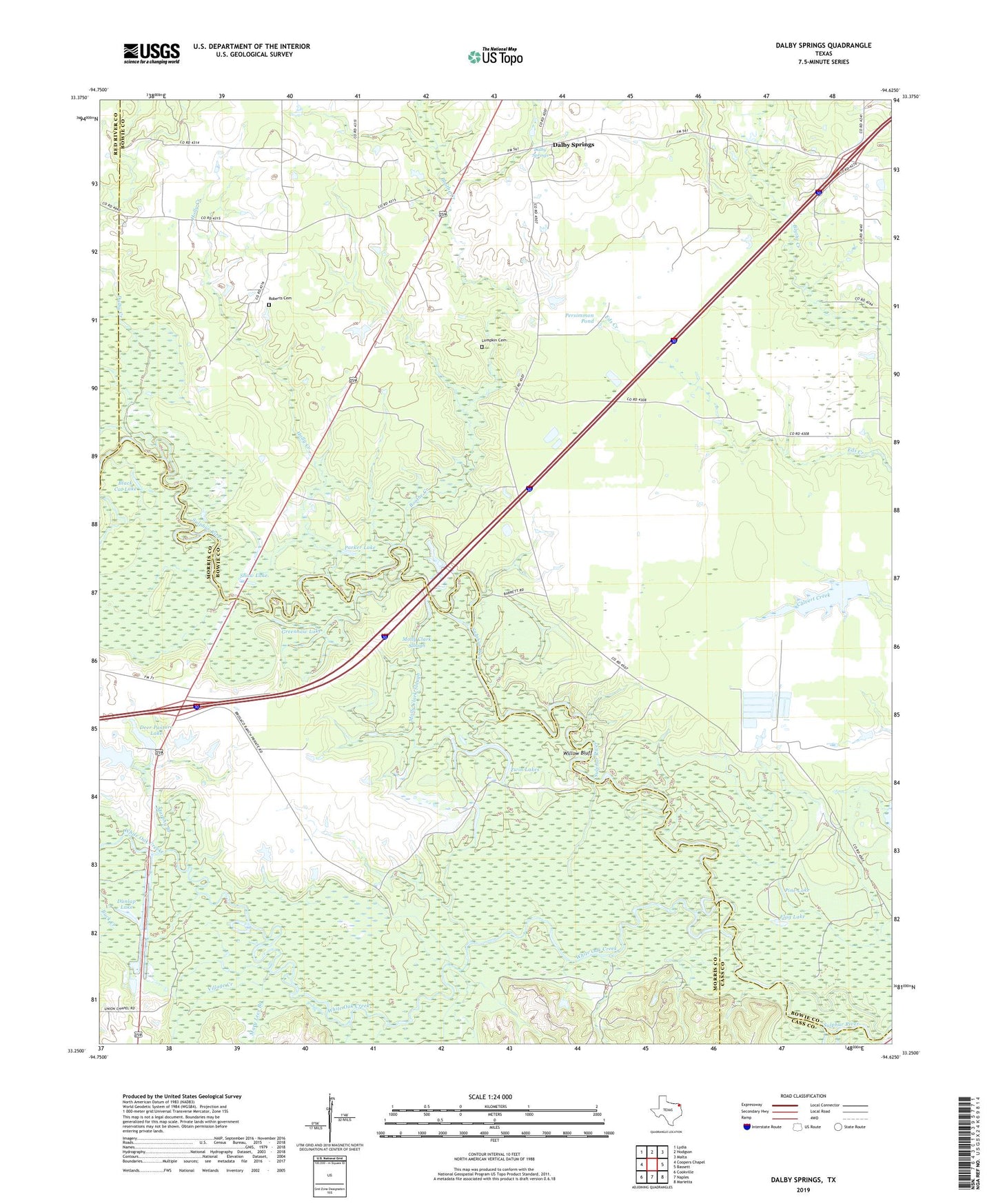
2022 topographic map quadrangle Dalby Springs in the state of Texas. Scale: 1:24000. Based on the newly updated USGS 7.5' US Topo map series, this map is in the following counties: Bowie, Morris, Red River, Cass. The map contains contour data, water features, and other items you are used to seeing on USGS maps, but also has updated roads and other features. This is the next generation of topographic maps. Printed on high-quality waterproof paper with UV fade-resistant inks.
Quads adjacent to this one:
West: Coopers Chapel
Northwest: Lydia
North: Hodgson
Northeast: Malta
East: Bassett
Southeast: Marietta
South: Naples
Southwest: Cookville
This map covers the same area as the classic USGS quad with code o33094c6.
Contains the following named places: Black Cat Lake, Boothe Creek, Broseco Dam Number 1, Broseco Ranch, County Line Church, Dalby Creek, Dalby Springs, Deer Pasture Dam, Deer Pasture Lake, Dunlap Lake, Flag Lake, Greenhaw Lake, Holly Creek, Lumpkin Cemetery, Mary Lees Branch, Molly Clark Slough, Murphy Branch, Parker Lake, Persimmon Pond, Pine Lake, Reddon Lake, Roberts Cemetery, Round Lake, Shaw Lake, Twin Lakes, Village Creek, Ward Creek, White Oak Creek, Willow Bluff