MyTopo
Bee Canyon Texas US Topo Map
Couldn't load pickup availability
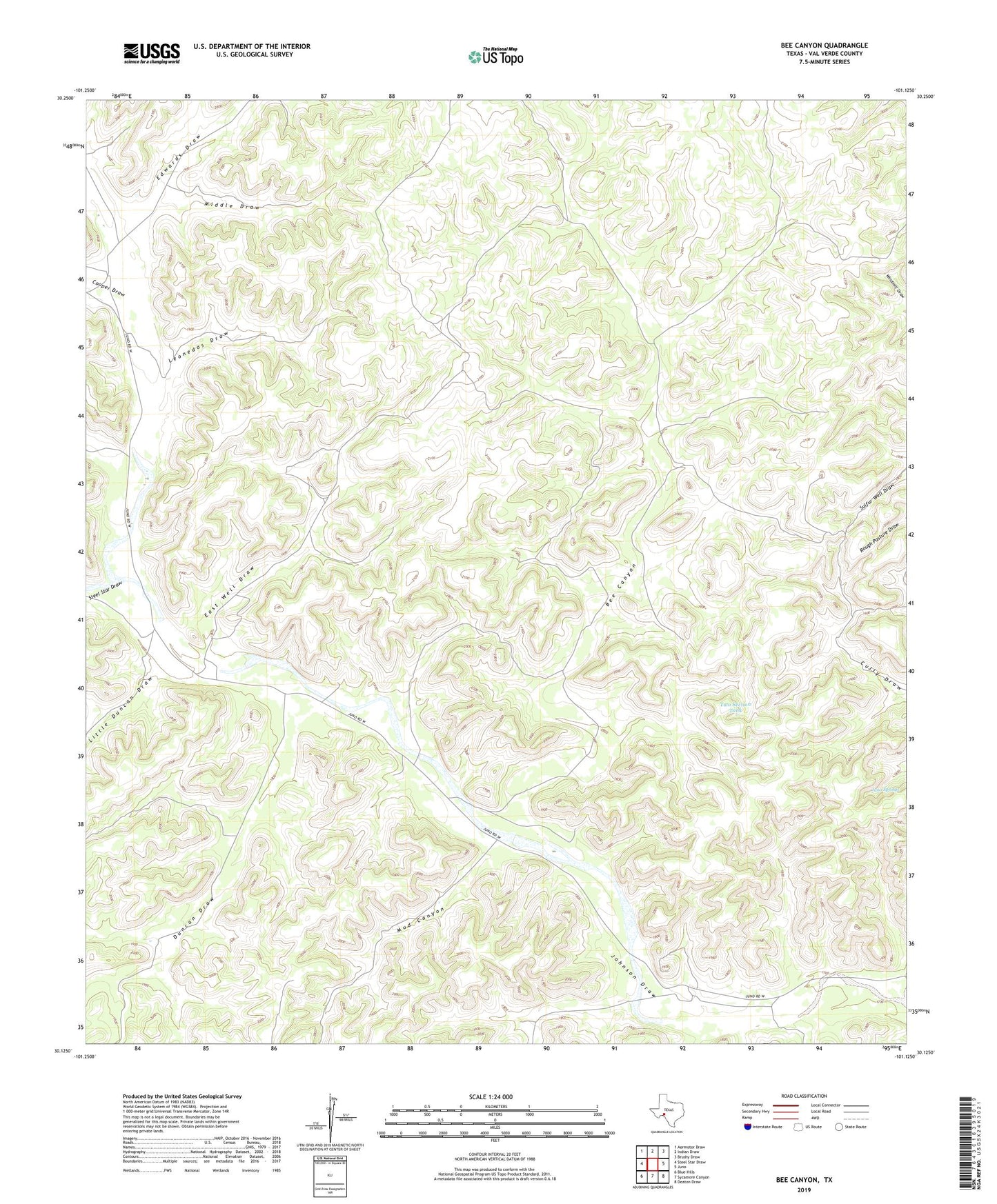
2022 topographic map quadrangle Bee Canyon in the state of Texas. Scale: 1:24000. Based on the newly updated USGS 7.5' US Topo map series, this map is in the following counties: Val Verde. The map contains contour data, water features, and other items you are used to seeing on USGS maps, but also has updated roads and other features. This is the next generation of topographic maps. Printed on high-quality waterproof paper with UV fade-resistant inks.
Quads adjacent to this one:
West: Steel Star Draw
Northwest: Aermotor Draw
North: Indian Draw
Northeast: Brushy Draw
East: Juno
Southeast: Deaton Draw
South: Sycamore Canyon
Southwest: Blue Hills
This map covers the same area as the classic USGS quad with code o30101b2.
Contains the following named places: Bee Canyon, Cooper Draw, Double Gates Windmill, Duncan Draw, East Well, East Well Draw, Edwards Draw, Finney Tank, High Lonesome Windmill, Johnson Draw, Juno Springs, Leonedas Draw, Little Duncan Draw, Massie West Ranch, Mayfield Ranch, Middle Draw, Miguel Windmill, Mud Canyon, Rough Pasture Windmill, Samson Windmill, Star Windmill, Steel Star Draw, Sulfur Well, Two Section Tank, Two Section Windmill, Wayne West Ranch, Wilson Windmill