MyTopo
Indian Draw Texas US Topo Map
Couldn't load pickup availability
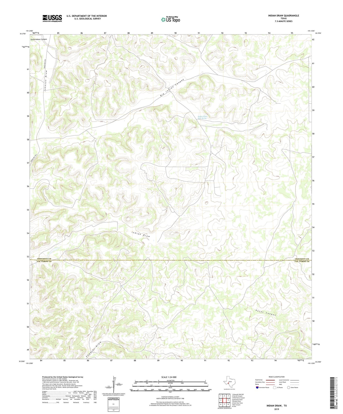
2022 topographic map quadrangle Indian Draw in the state of Texas. Scale: 1:24000. Based on the newly updated USGS 7.5' US Topo map series, this map is in the following counties: Crockett, Val Verde. The map contains contour data, water features, and other items you are used to seeing on USGS maps, but also has updated roads and other features. This is the next generation of topographic maps. Printed on high-quality waterproof paper with UV fade-resistant inks.
Quads adjacent to this one:
West: Aermotor Draw
Northwest: Howards Well NE
North: Harrell Canyon
Northeast: Wild Horse Canyon
East: Brushy Draw
Southeast: Juno
South: Bee Canyon
Southwest: Steel Star Draw
This map covers the same area as the classic USGS quad with code o30101c2.
Contains the following named places: Big Indian Canyon, Big Indian Waterhole Windmill, Divide Windmill, East Indian Windmill, Government Canyon, Indian Draw, Indian Water Hole Spring, Indian Waterhole Windmill, Indian Windmill, Marley Ranch, North Wilson Windmill, Quien Sabe Windmill