MyTopo
Ben Wheeler Texas US Topo Map
Couldn't load pickup availability
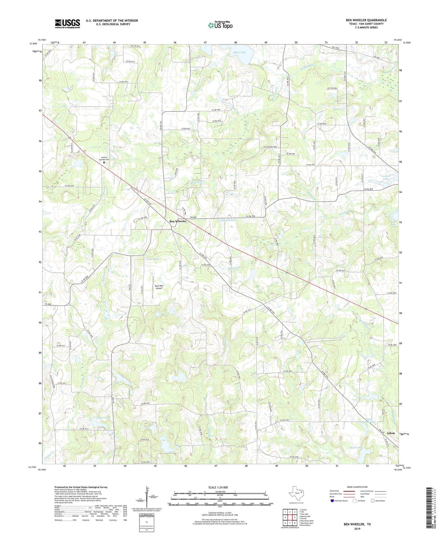
2019 topographic map quadrangle Ben Wheeler in the state of Texas. Scale: 1:24000. Based on the newly updated USGS 7.5' US Topo map series, this map is in the following counties: Van Zandt. The map contains contour data, water features, and other items you are used to seeing on USGS maps, but also has updated roads and other features. This is the next generation of topographic maps. Printed on high-quality waterproof paper with UV fade-resistant inks.
Quads adjacent to this one:
West: Martins Mill
Northwest: Canton
North: Van
Northeast: Van Lake
East: Carroll
Southeast: Brownsboro
South: Murchison East
Southwest: Murchison West
Contains the following named places: Arc Ridge School, Bear Creek Branch Library, Ben Wheeler, Ben Wheeler Census Designated Place, Ben Wheeler Post Office, Ben Wheeler-Edom Division, Bethlehem Branch, Bethlehem Church, Browning Creek, Cantrell Lake, Cantrell Lake Dam, Carter Spring, D W Smart Lake Dam, Hand Lake, Hand Lake Dam, Madcat Branch, Mitchell Lake, Payne Ranch Lake, Payne Ranch Lake Dam, Pine Bluff School, Prairie Creek, Prairie Springs Cemetery, Rhine Lake, Rhine Lake Dam, Smart Lake, Smith Chapel, Sour Branch, Stanger Springs Church, Turkey Creek, Vaca Moo Airport, Van Zandt County Constable's Office Precinct 4, Watts Church, Watts School, Williams Lake Dam, ZIP Code: 75754