MyTopo
Carroll Texas US Topo Map
Couldn't load pickup availability
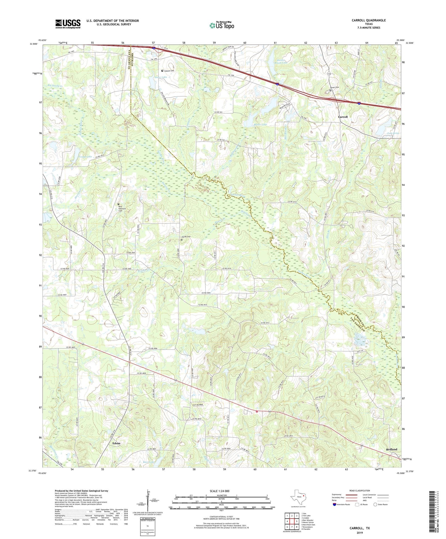
2022 topographic map quadrangle Carroll in the state of Texas. Scale: 1:24000. Based on the newly updated USGS 7.5' US Topo map series, this map is in the following counties: Van Zandt, Smith. The map contains contour data, water features, and other items you are used to seeing on USGS maps, but also has updated roads and other features. This is the next generation of topographic maps. Printed on high-quality waterproof paper with UV fade-resistant inks.
Quads adjacent to this one:
West: Ben Wheeler
Northwest: Van
North: Van Lake
Northeast: Lindale
East: Mount Sylvan
Southeast: Chandler
South: Brownsboro
Southwest: Murchison East
This map covers the same area as the classic USGS quad with code o32095d5.
Contains the following named places: Allen Branch, Bass Lake, Basslake Airport, Big Sandy Creek, Butler Dam, Butler Lake, Caney Creek, Carroll, Clark Spring, Clear Spring Church, Cypress Creek Branch Library, Dover Cemetery, Galena Cemetery, Galena Church, Horsley Creek, Hunter Brush Dam, Hunter Brush Lake, Jacob Cemetery, Midway, Midway Volunteer Fire Department, Mill Break Creek, New Harmony Cemetery, Pleasant Hill Church, Prairie Creek, Prairie Creek School, Primrose, Primrose School, Rattlesnake Creek, Sexton Chapel, Shiloh Lake, Starr Lake, Starr Lake Dam, Young Lake, Young Lake Dam