MyTopo
Brownsboro Texas US Topo Map
Couldn't load pickup availability
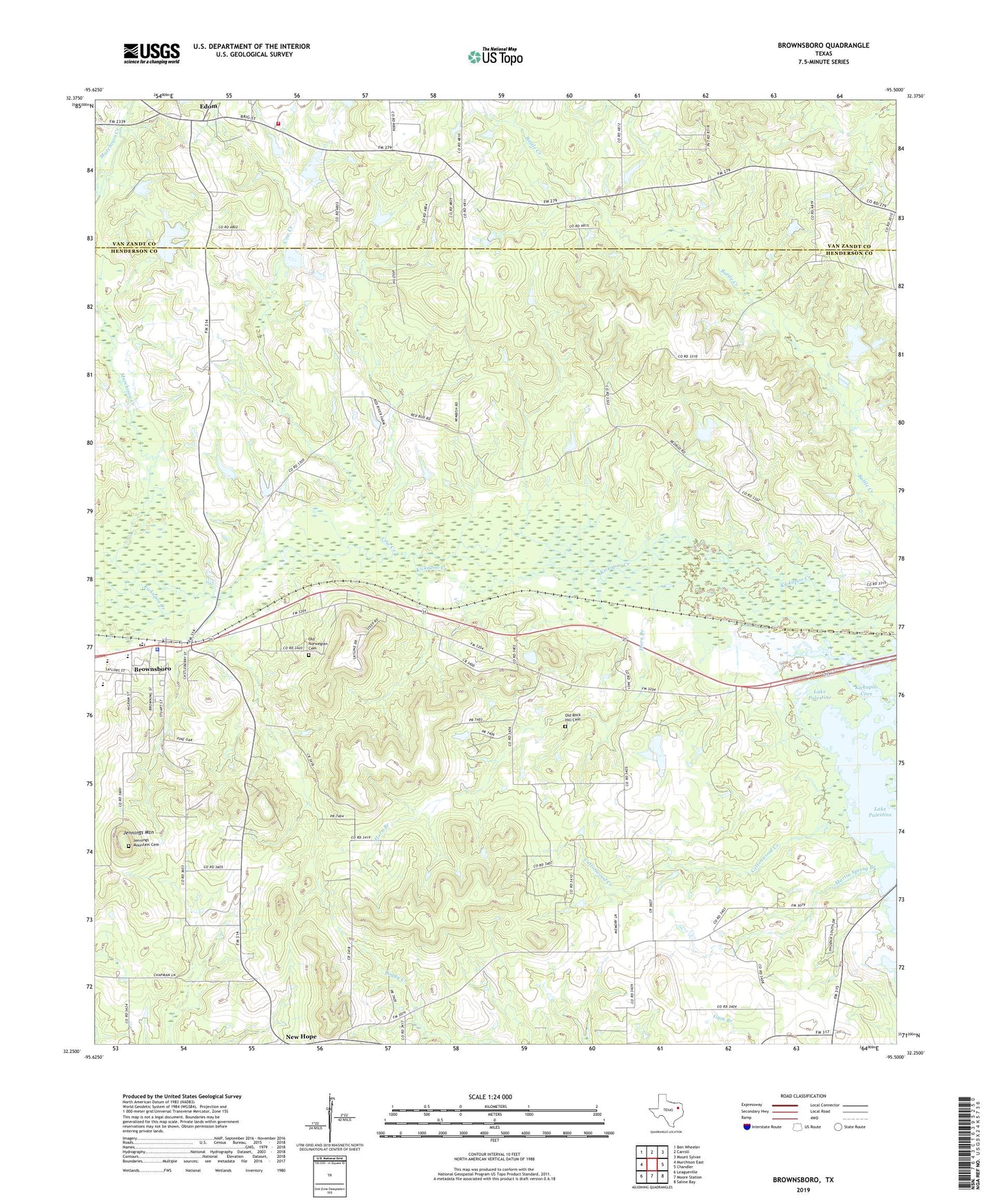
2022 topographic map quadrangle Brownsboro in the state of Texas. Scale: 1:24000. Based on the newly updated USGS 7.5' US Topo map series, this map is in the following counties: Henderson, Van Zandt. The map contains contour data, water features, and other items you are used to seeing on USGS maps, but also has updated roads and other features. This is the next generation of topographic maps. Printed on high-quality waterproof paper with UV fade-resistant inks.
Quads adjacent to this one:
West: Murchison East
Northwest: Ben Wheeler
North: Carroll
Northeast: Mount Sylvan
East: Chandler
Southeast: Saline Bay
South: Moore Station
Southwest: Leagueville
This map covers the same area as the classic USGS quad with code o32095c5.
Contains the following named places: Bass Lake Dam, Battle Creek, Brownsboro, Brownsboro City Hall, Brownsboro Police Department, Brownsboro Post Office, Chandler-Brownsboro Division, City of Brownsboro, City of Edom, Cottonwood Creek, Cow Creek, Echols Cemetery on Jennings Mountain, Edom, Edom City Hall, Edom Volunteer Fire Department, Evelyn, Horn Branch, Jennings Mountain, Kickapoo Cove, Martin Spring Church, Martin Springs Baptist Church, Murchison Creek, New Hope, Old Norwegian Cemetery, Old Rock Hill Cemetery, Pine Hill Church, Rock Hill Church, Union Hill, Union Hill Church, ZIP Codes: 75756, 75758