MyTopo
Bernardo Texas US Topo Map
Couldn't load pickup availability
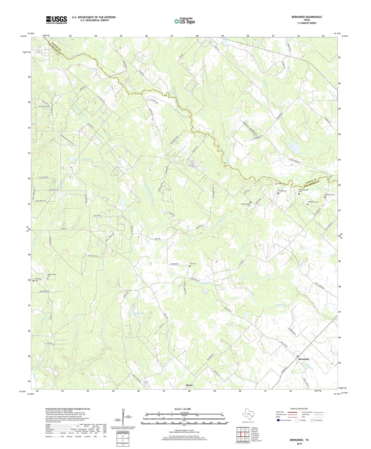
2019 topographic map quadrangle Bernardo in the state of Texas. Scale: 1:24000. Based on the newly updated USGS 7.5' US Topo map series, this map is in the following counties: Colorado, Austin. The map contains contour data, water features, and other items you are used to seeing on USGS maps, but also has updated roads and other features. This is the next generation of topographic maps. Printed on high-quality waterproof paper with UV fade-resistant inks.
Quads adjacent to this one:
West: Frelsburg
Northwest: Industry
North: New Ulm
Northeast: Bellville
East: Cat Spring
Southeast: Eagle Lake NE
South: Alleyton
Southwest: Columbus
Contains the following named places: Bailey Lake, Bailey Lake Dam, Bernardo, Bernardo School, Bernardo Volunteer Fire Department, Bretschneider Cemetery, Colorado County Constable's Office Precinct 3, Gaedecker Cemetery, Hayes Creek, Himley Cemetery, Hinks Cemetery, Jones Creek, Kansteiner Cemetery, Kellner Cemetery, Mentz, Reichardt Cemetery, Saint Rochs Church, Schmitt Creek, Sommerlotte Cemetery, Zion Cemetery