MyTopo
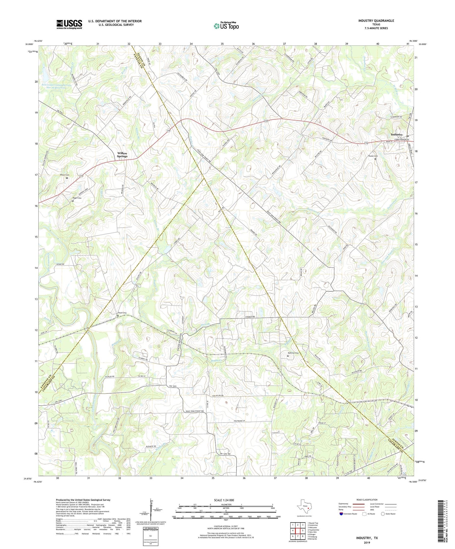
Industry Texas US Topo Map
Couldn't load pickup availability
2022 topographic map quadrangle Industry in the state of Texas. Scale: 1:24000. Based on the newly updated USGS 7.5' US Topo map series, this map is in the following counties: Austin, Colorado, Fayette. The map contains contour data, water features, and other items you are used to seeing on USGS maps, but also has updated roads and other features. This is the next generation of topographic maps. Printed on high-quality waterproof paper with UV fade-resistant inks.
Quads adjacent to this one:
West: Fayetteville
Northwest: Round Top
North: Greenvine
Northeast: Welcome
East: New Ulm
Southeast: Bernardo
South: Frelsburg
Southwest: Ellinger
This map covers the same area as the classic USGS quad with code o29096h5.
Contains the following named places: Albert Cemetery, Bethune School, Boggy Creek, Cherry Chapel, Cliff Creek, Dogwood Creek, Floyd Cemetery, Industry, Industry Post Office, Knolle Cemetery, Kreb Branch, Krebsville, Lone Oak, McElroy Cemetery, Mesquite Public Library, Pagel Cemetery, Pisek, Pool Branch, Poplar Creek, Post Oak Point, Rock House, Rockhouse, Sawmill Creek, Soil Conservation Service Site 26 Dam, Soil Conservation Service Site 26 Reservoir, Stein Branch, West End School, Willow Branch, Willow Springs