MyTopo
Sneed Mountain NE Texas US Topo Map
Couldn't load pickup availability
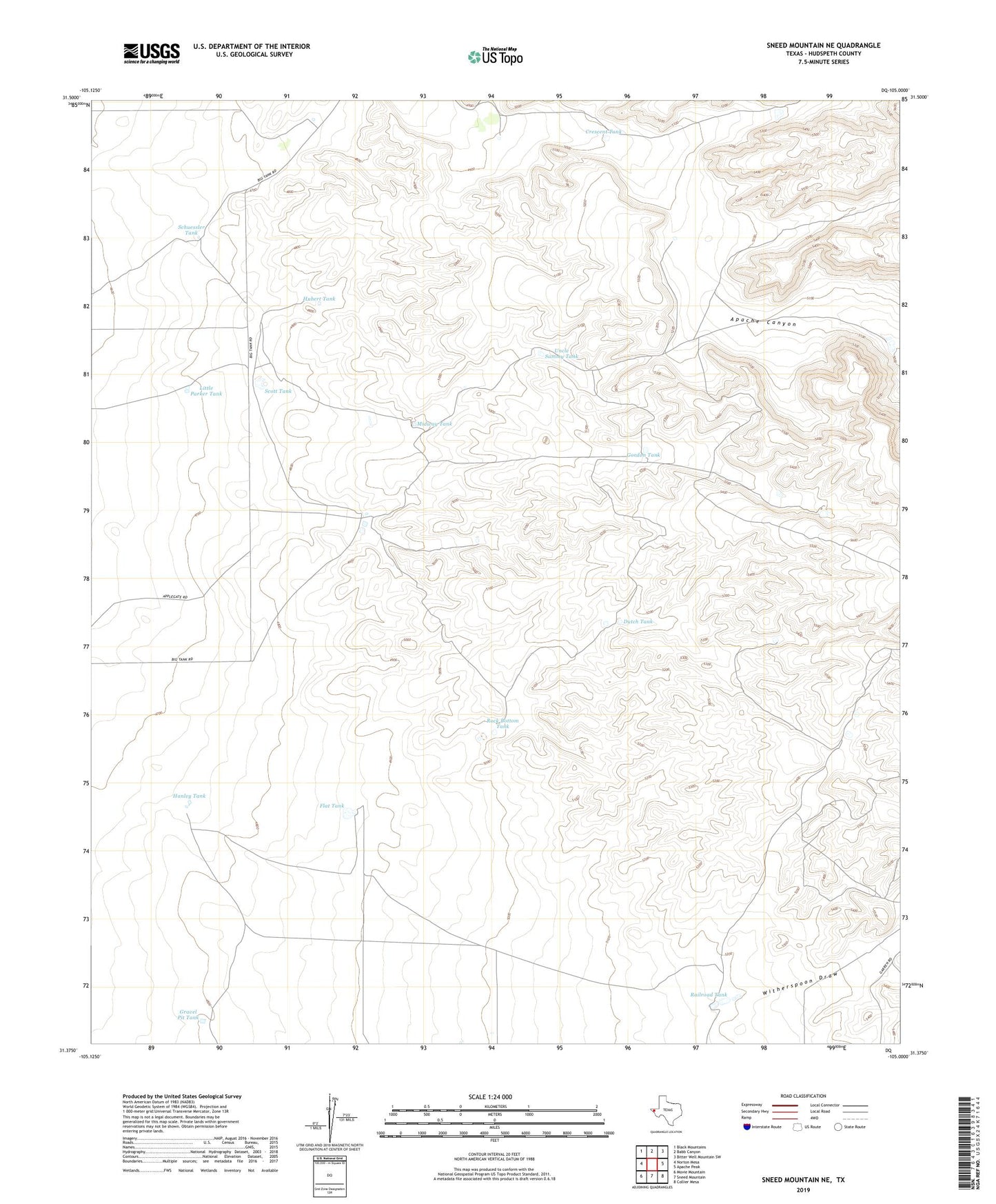
2022 topographic map quadrangle Sneed Mountain NE in the state of Texas. Scale: 1:24000. Based on the newly updated USGS 7.5' US Topo map series, this map is in the following counties: Hudspeth. The map contains contour data, water features, and other items you are used to seeing on USGS maps, but also has updated roads and other features. This is the next generation of topographic maps. Printed on high-quality waterproof paper with UV fade-resistant inks.
Quads adjacent to this one:
West: Norton Mesa
Northwest: Black Mountains
North: Babb Canyon
Northeast: Bitter Well Mountain SW
East: Apache Peak
Southeast: Collier Mesa
South: Sneed Mountain
Southwest: Movie Mountain
This map covers the same area as the classic USGS quad with code o31105d1.
Contains the following named places: Big Tank Ranch Airport, Crescent Tank, Dutch Tank, Flat Tank, Gordon Tank, Gravel Pit Tank, Hanley Tank, Honeycutt Ranch, Hubert Tank, Little Parker Tank, Midway Tank, Railroad Tank, Rock Bottom Tank, Schuessler Tank, Scott Tank, Uncle Sammy Tank, Witherspoon Draw