MyTopo
Blancas Creek North Texas US Topo Map
Couldn't load pickup availability
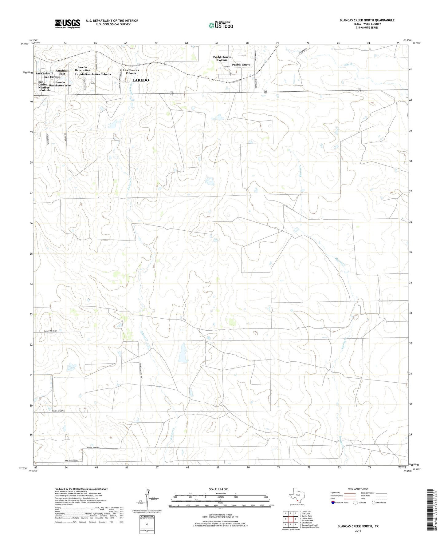
2022 topographic map quadrangle Blancas Creek North in the state of Texas. Scale: 1:24000. Based on the newly updated USGS 7.5' US Topo map series, this map is in the following counties: Webb. The map contains contour data, water features, and other items you are used to seeing on USGS maps, but also has updated roads and other features. This is the next generation of topographic maps. Printed on high-quality waterproof paper with UV fade-resistant inks.
Quads adjacent to this one:
West: Laredo South
Northwest: Laredo East
North: Tios Creek
Northeast: Burrito Tank
East: Retama Creek
Southeast: Agua Azul Creek West
South: Blancas Creek South
This map covers the same area as the classic USGS quad with code o27099d3.
Contains the following named places: Flores Lake, Flores Lake Dam, Laredo Ranchettes, Laredo Ranchettes Census Designated Place, Laredo Ranchettes Colonia, Laredo Ranchettes West Census Designated Place, Las Blancas Colonia, Pueblo Nuevo, Pueblo Nuevo Census Designated Place, Pueblo Nuevo Colonia, Ranchitos 359 East Colonia, Ranchitos East Census Designated Place, San Carlos I Census Designated Place, San Carlos II Census Designated Place, San Carlos Number 1 Colonia, San Carlos Number 2 Colonia, Trevino Lake, Trevino Lake Dam