MyTopo
Retama Creek Texas US Topo Map
Couldn't load pickup availability
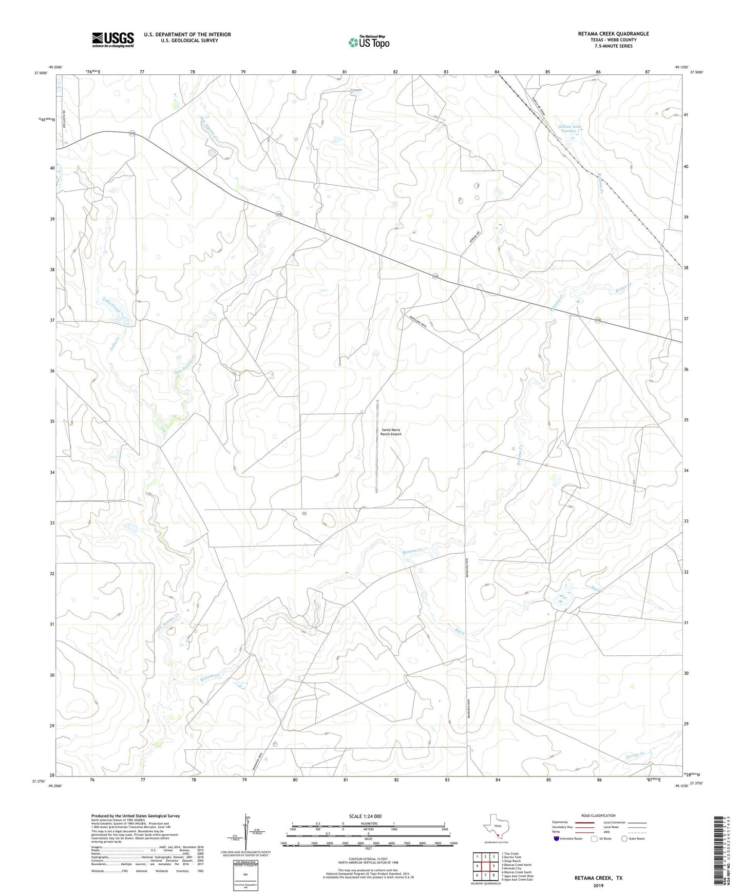
2022 topographic map quadrangle Retama Creek in the state of Texas. Scale: 1:24000. Based on the newly updated USGS 7.5' US Topo map series, this map is in the following counties: Webb. The map contains contour data, water features, and other items you are used to seeing on USGS maps, but also has updated roads and other features. This is the next generation of topographic maps. Printed on high-quality waterproof paper with UV fade-resistant inks.
Quads adjacent to this one:
West: Blancas Creek North
Northwest: Tios Creek
North: Burrito Tank
Northeast: Shipp Ranch
East: Mirando City
Southeast: Agua Azul Creek East
South: Agua Azul Creek West
Southwest: Blancas Creek South
This map covers the same area as the classic USGS quad with code o27099d2.
Contains the following named places: Hirsch Estate Lake, Hirsch Estate Lake Dam, Killam Lake Number 1, Killam Lake Number 1 Dam, Killam Siding, Lobo Creek, Martin Lake, Martin Lake Dam, Reiser Creek, Retama Creek, Ryo Creek, Santa Maria Ranch Airport