MyTopo
Bluegrove Texas US Topo Map
Couldn't load pickup availability
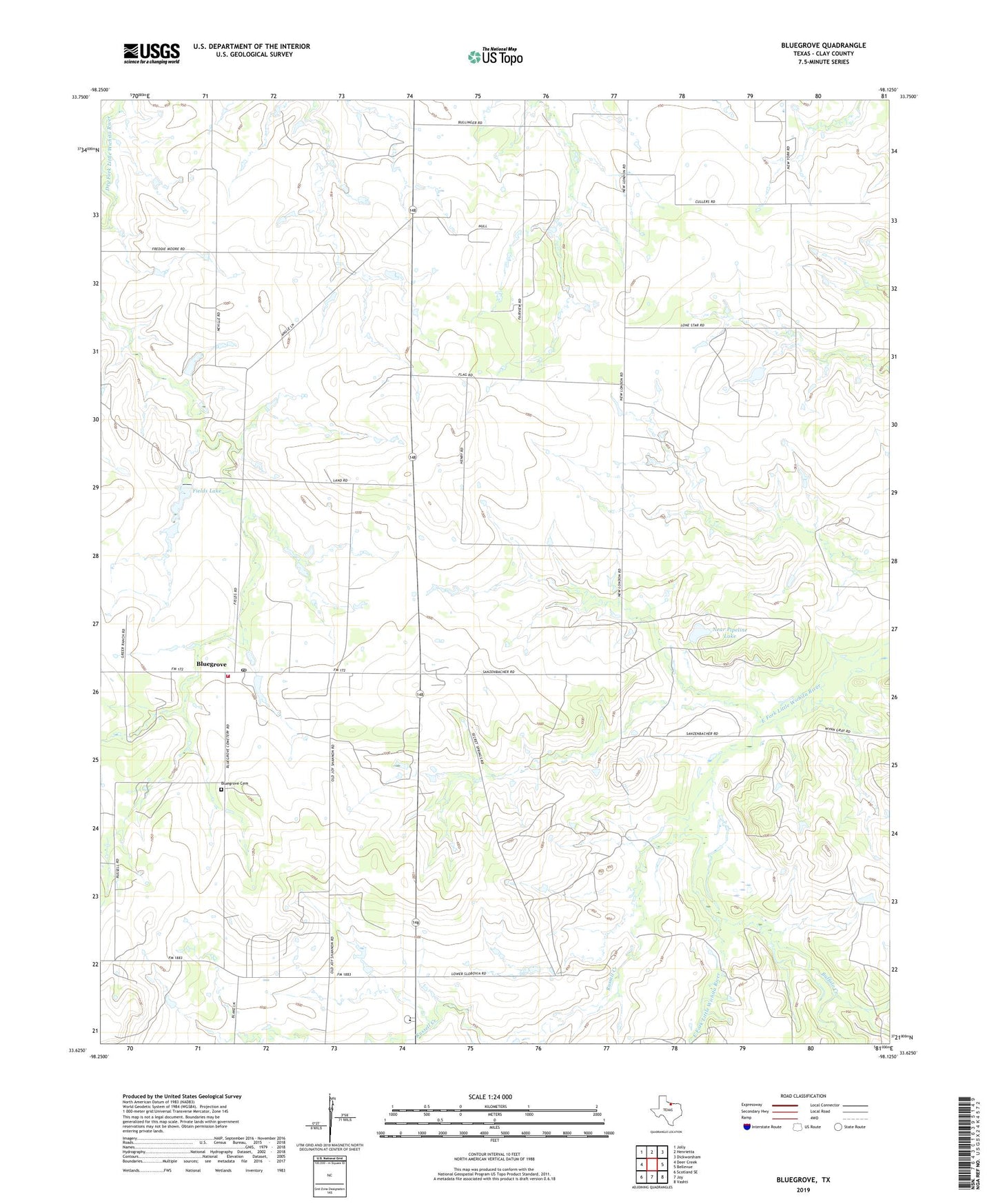
2022 topographic map quadrangle Bluegrove in the state of Texas. Scale: 1:24000. Based on the newly updated USGS 7.5' US Topo map series, this map is in the following counties: Clay. The map contains contour data, water features, and other items you are used to seeing on USGS maps, but also has updated roads and other features. This is the next generation of topographic maps. Printed on high-quality waterproof paper with UV fade-resistant inks.
Quads adjacent to this one:
West: Deer Creek
Northwest: Jolly
North: Henrietta
Northeast: Dickworsham
East: Bellevue
Southeast: Vashti
South: Joy
Southwest: Scotland SE
This map covers the same area as the classic USGS quad with code o33098f2.
Contains the following named places: Bluegrove, Bluegrove Cemetery, Bluegrove Oil Field, Bluegrove Post Office, Bluegrove Volunteer Fire Department, Buffalo Creek, Fields Lake, Fields Lake Dam, Midway School, Near Pipeline Lake, Near Pipeline Lake Dam, Russell Creek