MyTopo
Henrietta Texas US Topo Map
Couldn't load pickup availability
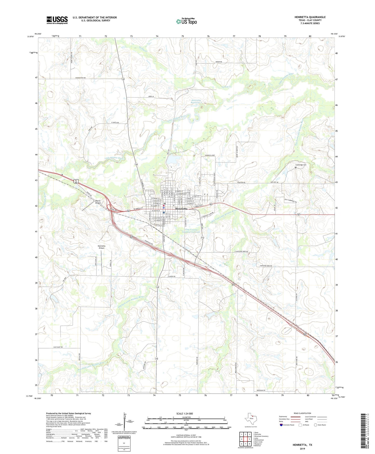
2022 topographic map quadrangle Henrietta in the state of Texas. Scale: 1:24000. Based on the newly updated USGS 7.5' US Topo map series, this map is in the following counties: Clay. The map contains contour data, water features, and other items you are used to seeing on USGS maps, but also has updated roads and other features. This is the next generation of topographic maps. Printed on high-quality waterproof paper with UV fade-resistant inks.
Quads adjacent to this one:
West: Jolly
Northwest: Dean
North: Hurnville
Northeast: Riverland Cemetery
East: Dickworsham
Southeast: Bellevue
South: Bluegrove
Southwest: Deer Creek
This map covers the same area as the classic USGS quad with code o33098g2.
Contains the following named places: Cambridge Cemetery, Church of Christ of Henrietta, City of Henrietta, Clay County, Clay County Constable's Office, Clay County Country Club Lake, Clay County Country Club Lake Dam, Clay County Jail, Clay County Memorial Hospital, Clay County Sheriff's Office, First Baptist Church, Frame, Grace Temple Baptist Church, Hapgood Field, Henrietta, Henrietta Airport, Henrietta City Hall, Henrietta City Reservoir 1 Dam, Henrietta Division, Henrietta Elementary School, Henrietta High School, Henrietta Junior High School, Henrietta Lake, Henrietta Post Office, Henrietta Primitive Baptist Church, Henrietta Reservoir 2, Henrietta Reservoir 2 Dam, Henrietta Volunteer Fire Department, Pierce Airport, Trinity Episcopal Church, Turkey Creek, ZIP Code: 76365