MyTopo
Bon Wier Texas US Topo Map
Couldn't load pickup availability
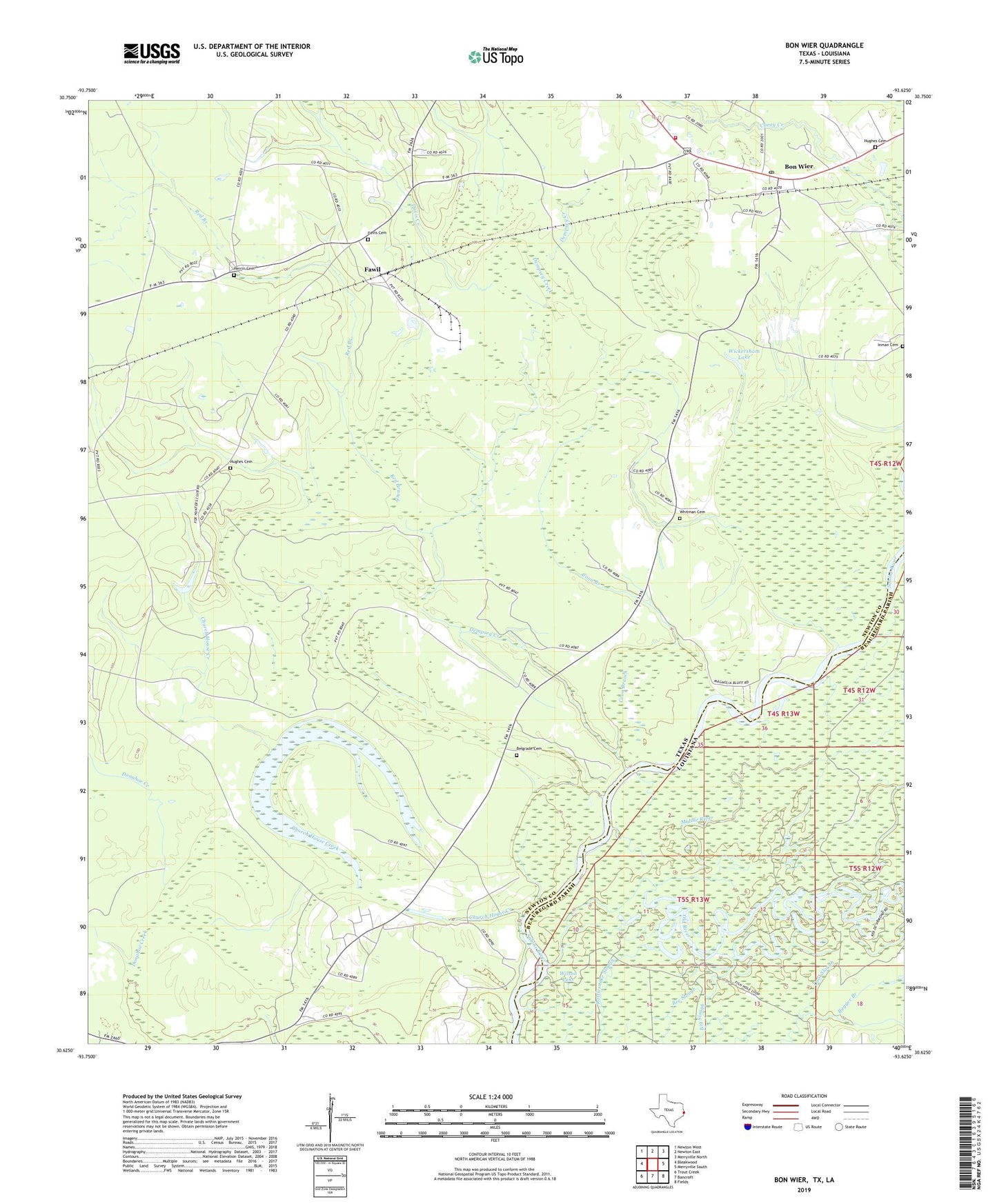
2022 topographic map quadrangle Bon Wier in the states of Texas, Louisiana. Scale: 1:24000. Based on the newly updated USGS 7.5' US Topo map series, this map is in the following counties: Newton, Beauregard. The map contains contour data, water features, and other items you are used to seeing on USGS maps, but also has updated roads and other features. This is the next generation of topographic maps. Printed on high-quality waterproof paper with UV fade-resistant inks.
Quads adjacent to this one:
West: Bleakwood
Northwest: Newton West
North: Newton East
Northeast: Merryville North
East: Merryville South
Southeast: Fields
South: Bancroft
Southwest: Trout Creek
This map covers the same area as the classic USGS quad with code o30093f6.
Contains the following named places: Arch Creek, Belgrade, Belgrade Cemetery, Bon Wier, Bon Wier Post Office, Bon Wier Volunteer Fire Department, Church House Creek, Coon Branch, Davis Cemetery, Davis Creek, Dempsey Creek, Fawil, Hassle Branch, Herrin Cemetery, Hughes Cemetery, Middle River, Old River, Red Branch, Sandjack, Whitman Cemetery, Wickersham Dam, Wickersham Lake, Wilson Lake, ZIP Code: 75928