MyTopo
Newton East Texas US Topo Map
Couldn't load pickup availability
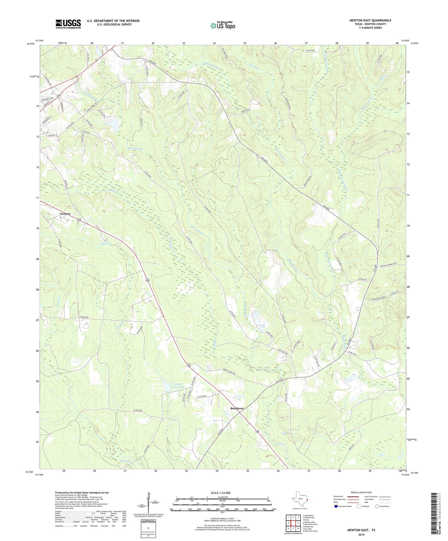
2022 topographic map quadrangle Newton East in the state of Texas. Scale: 1:24000. Based on the newly updated USGS 7.5' US Topo map series, this map is in the following counties: Newton. The map contains contour data, water features, and other items you are used to seeing on USGS maps, but also has updated roads and other features. This is the next generation of topographic maps. Printed on high-quality waterproof paper with UV fade-resistant inks.
Quads adjacent to this one:
West: Newton West
Northwest: Jamestown
North: Shankleville
Northeast: Evans
East: Merryville North
Southeast: Merryville South
South: Bon Wier
Southwest: Bleakwood
This map covers the same area as the classic USGS quad with code o30093g6.
Contains the following named places: Bon Wier Lookout Tower, Buckhorn, Ford Church, Hackberry Branch, Little Quicksand Creek, Mill Creek, Moore Branch, Newton County, Newton County Constable's Office Precinct 2, Newton Division, Quicksand Church, Temple Eastex Dam, Temple Eastex Lake, Threemile Branch, Underwood Creek, Union Church, West Bethlehem Church, ZIP Code: 75966