MyTopo
Newton West Texas US Topo Map
Couldn't load pickup availability
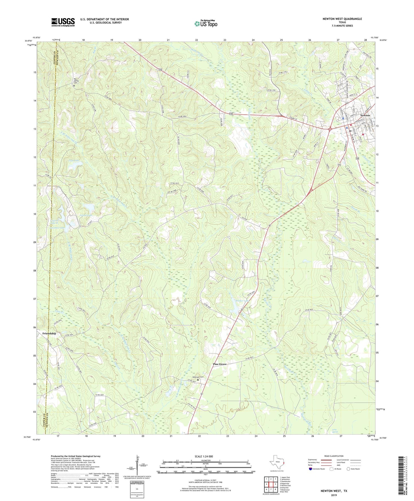
2022 topographic map quadrangle Newton West in the state of Texas. Scale: 1:24000. Based on the newly updated USGS 7.5' US Topo map series, this map is in the following counties: Newton, Jasper. The map contains contour data, water features, and other items you are used to seeing on USGS maps, but also has updated roads and other features. This is the next generation of topographic maps. Printed on high-quality waterproof paper with UV fade-resistant inks.
Quads adjacent to this one:
West: Roganville
Northwest: Jasper East
North: Jamestown
Northeast: Shankleville
East: Newton East
Southeast: Bon Wier
South: Bleakwood
Southwest: Kirbyville
This map covers the same area as the classic USGS quad with code o30093g7.
Contains the following named places: Big Spring Cemetery, City of Newton, Clare Creek, Clare Creek School, Club Lake, Club Lake Dam, Coastal Dam D, Coastal Lake D, East Branch White Oak Creek, East Texas Baptist Encampment, Friendship, Hunter Creek, Island Lake, Island Lake Dam, Javalina Lake, Javalina Lake Dam, Melhomes Creek, Newton, Newton City Hall, Newton County History Center, Newton County Sheriff's Office, Newton Police Department, Newton Post Office, Newton Volunteer Fire Department, Pine Grove, Walker Lake, Walker Lake Dam, West Branch White Oak Creek, Wilkinson Cemetery, Woodville School