MyTopo
Boonsville Texas US Topo Map
Couldn't load pickup availability
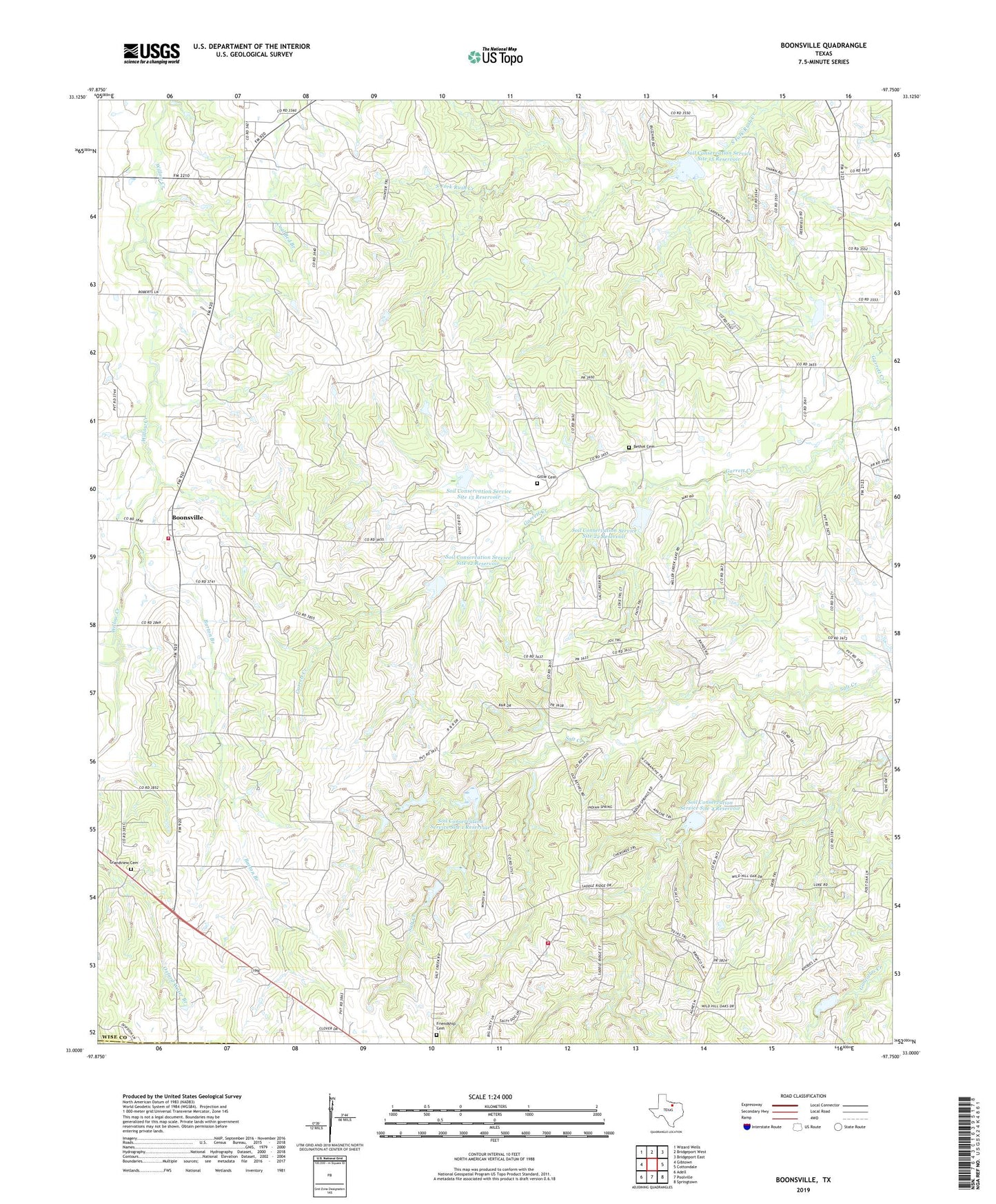
2019 topographic map quadrangle Boonsville in the state of Texas. Scale: 1:24000. Based on the newly updated USGS 7.5' US Topo map series, this map is in the following counties: Wise, Parker. The map contains contour data, water features, and other items you are used to seeing on USGS maps, but also has updated roads and other features. This is the next generation of topographic maps. Printed on high-quality waterproof paper with UV fade-resistant inks.
Quads adjacent to this one:
West: Gibtown
Northwest: Wizard Wells
North: Bridgeport West
Northeast: Bridgeport East
East: Cottondale
Southeast: Springtown
South: Poolville
Southwest: Adell
Contains the following named places: Balsora, Barton Branch, Bethel Cemetery, Boonsville, Boonsville - Balsora Volunteer Fire Department, Boonsville Gas Field, Friendship Cemetery, Gillie Cemetery, Grandview Cemetery, North Fork Willow Creek, Salt Creek Volunteer Fire Department, Soil Conservation Service Site 1 Dam, Soil Conservation Service Site 1 Reservoir, Soil Conservation Service Site 12 Dam, Soil Conservation Service Site 12 Reservoir, Soil Conservation Service Site 13 Dam, Soil Conservation Service Site 13 Reservoir, Soil Conservation Service Site 14 Dam, Soil Conservation Service Site 14 Reservoir, Soil Conservation Service Site 15 Dam, Soil Conservation Service Site 15 Reservoir, Soil Conservation Service Site 2 Dam, Soil Conservation Service Site 2 Reservoir, Soil Conservation Service Site 22 Dam, Soil Conservation Service Site 22 Reservoir, Soil Conservation Service Site 4 Dam, Soil Conservation Service Site 4 Reservoir, Soil Conservation Service Site 5 Dam