MyTopo
Cottondale Texas US Topo Map
Couldn't load pickup availability
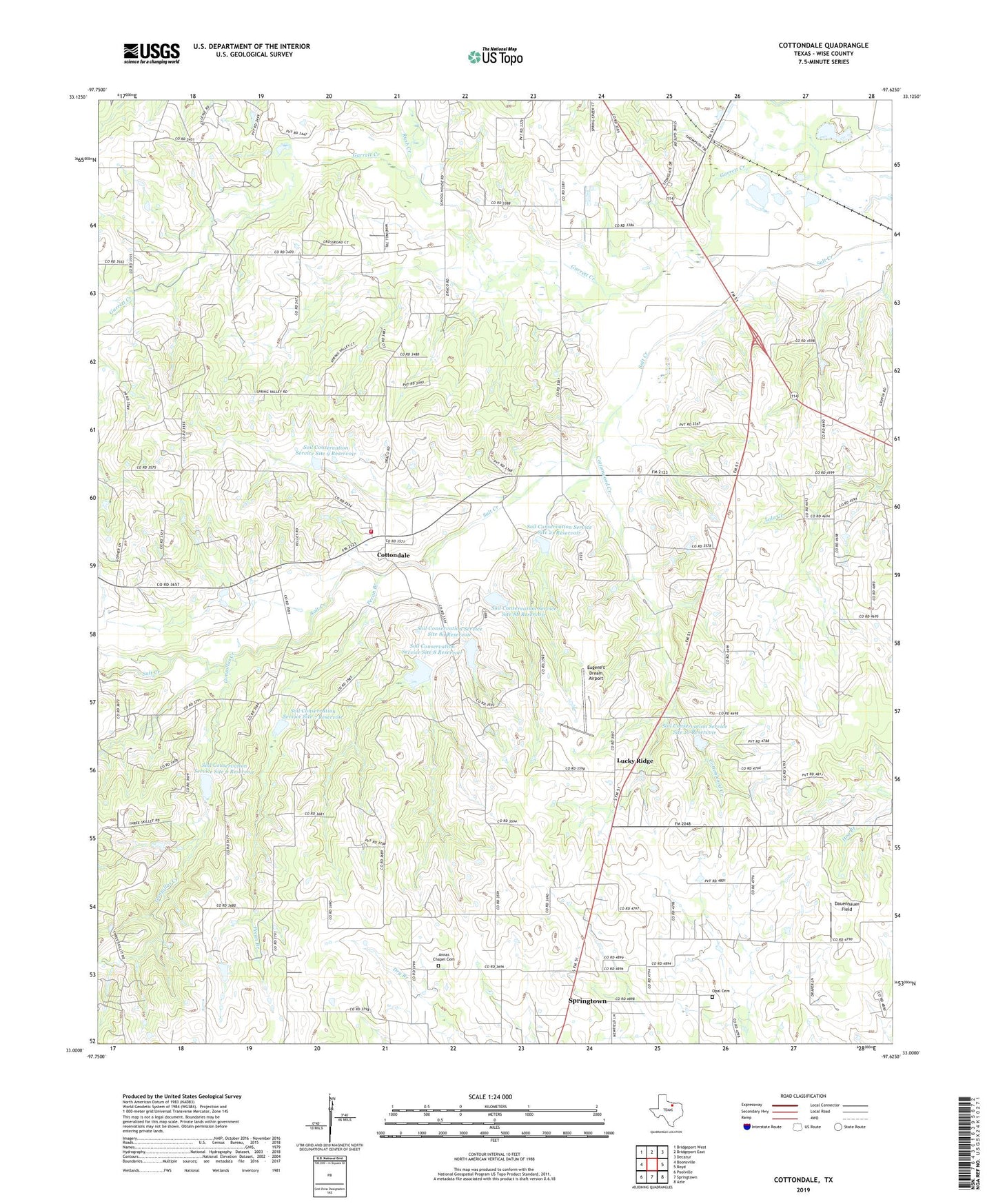
2022 topographic map quadrangle Cottondale in the state of Texas. Scale: 1:24000. Based on the newly updated USGS 7.5' US Topo map series, this map is in the following counties: Wise. The map contains contour data, water features, and other items you are used to seeing on USGS maps, but also has updated roads and other features. This is the next generation of topographic maps. Printed on high-quality waterproof paper with UV fade-resistant inks.
Quads adjacent to this one:
West: Boonsville
Northwest: Bridgeport West
North: Bridgeport East
Northeast: Decatur
East: Boyd
Southeast: Azle
South: Springtown
Southwest: Poolville
This map covers the same area as the classic USGS quad with code o33097a6.
Contains the following named places: Annas Chapel Cemetery, Cottondale, Cottondale Gas Field, Cottondale Volunteer Fire Department, Cottonwood Creek, Daly Gas Field, Dauenhauer Field, Draco, Eugene's Dream Airport, Friendship Church, Garvin Church, Gonzollas Creek, Lucky Ridge, Opal Cemetery, Paradise Gas Field, Pecan Branch, Rush Creek, Soil Conservation Service Site 10 Dam, Soil Conservation Service Site 10 Reservoir, Soil Conservation Service Site 21 Dam, Soil Conservation Service Site 21 Reservoir, Soil Conservation Service Site 5 Reservoir, Soil Conservation Service Site 6 Dam, Soil Conservation Service Site 6 Reservoir, Soil Conservation Service Site 7 Dam, Soil Conservation Service Site 7 Reservoir, Soil Conservation Service Site 8 Dam, Soil Conservation Service Site 8 Reservoir, Soil Conservation Service Site 8a Dam, Soil Conservation Service Site 8a Reservoir, Soil Conservation Service Site 8b Dam, Soil Conservation Service Site 8b Reservoir, Soil Conservation Service Site 9 Dam, Soil Conservation Service Site 9 Reservoir, ZIP Code: 76073