MyTopo
Bridgeport East Texas US Topo Map
Couldn't load pickup availability
Also explore the Bridgeport East Forest Service Topo of this same quad for updated USFS data
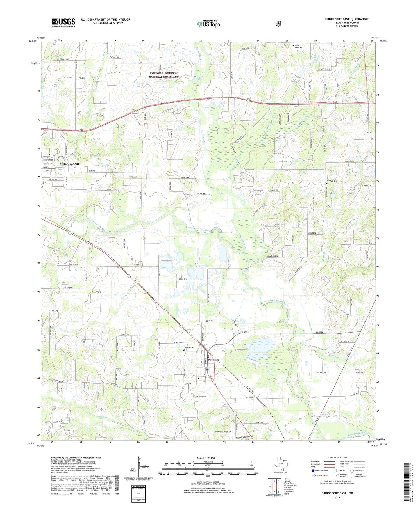
2022 topographic map quadrangle Bridgeport East in the state of Texas. Scale: 1:24000. Based on the newly updated USGS 7.5' US Topo map series, this map is in the following counties: Wise. The map contains contour data, water features, and other items you are used to seeing on USGS maps, but also has updated roads and other features. This is the next generation of topographic maps. Printed on high-quality waterproof paper with UV fade-resistant inks.
Quads adjacent to this one:
West: Bridgeport West
Northwest: Chico
North: Alvord
Northeast: Pecan Creek
East: Decatur
Southeast: Boyd
South: Cottondale
Southwest: Boonsville
This map covers the same area as the classic USGS quad with code o33097b6.
Contains the following named places: Big Sandy Creek, Briar Branch, Bridgeport Gas Field, Bridgeport Intermediate School, Bridgeport Middle School, City of Paradise, Cuba Church, Dry Creek, Eastside Cemetery, Jackson (Bill) Airport, KBTT-FM (Bridgeport), Martin Branch, Paradise, Paradise Cemetery, Paradise City Hall, Paradise Elementary School, Paradise Post Office, Paradise School, Paradise Volunteer Fire Department, Prescott Cemetery, Rosebud Branch, Saint Johns Catholic Church, Teate Field, Valley View Cemetery, Waggoner Branch, Watson Branch, Wise County