MyTopo
Springtown Texas US Topo Map
Couldn't load pickup availability
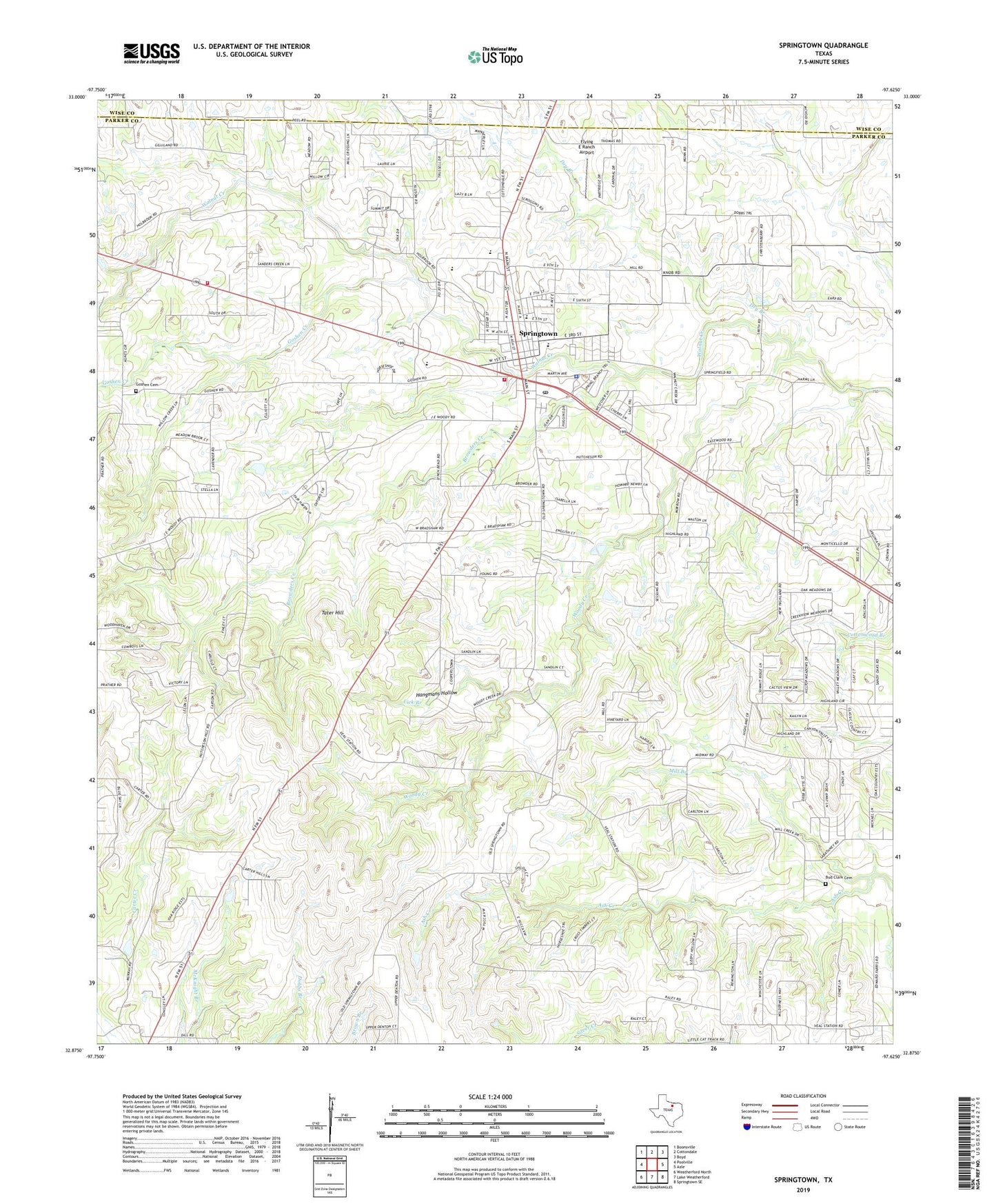
2022 topographic map quadrangle Springtown in the state of Texas. Scale: 1:24000. Based on the newly updated USGS 7.5' US Topo map series, this map is in the following counties: Parker, Wise. The map contains contour data, water features, and other items you are used to seeing on USGS maps, but also has updated roads and other features. This is the next generation of topographic maps. Printed on high-quality waterproof paper with UV fade-resistant inks.
Quads adjacent to this one:
West: Poolville
Northwest: Boonsville
North: Cottondale
Northeast: Boyd
East: Azle
Southeast: Springtown SE
South: Lake Weatherford
Southwest: Weatherford North
This map covers the same area as the classic USGS quad with code o32097h6.
Contains the following named places: Abundant Life Church of God, Browders Creek, Bud Clark Cemetery, Burkhalter Cemetery, Carter, Carter Census Designated Place, City of Springtown, Dry Branch, First Baptist Church, Flying E Ranch Airport, Fundamental Baptist Church, Goshen, Goshen Cemetery, Goshen Creek, Hangmans Hollow, Heritage Museum, Highland Addition, Highland Church, KMQX-FM (Springtown), Koontz Heliport Heliport, Lick Branch, Mill Branch, New Life Family Fellowship Church, Parker County Constable's Office Precinct 1, Porcupine Stadium, Springtown, Springtown Cemetery, Springtown City Hall, Springtown Hinkle Elementary School, Springtown Lipstreu Elementary School, Springtown Oil Field, Springtown Police Department, Springtown Post Office, Springtown Volunteer Fire Department, Springtown Volunteer Fire Department Station 2, Springtown Watson Elementary School, Springtown-Reno Division, Tater Hill, Underline Ok Airport, Veal Station, Veal Station Cemetery, Woody Creek, Woody Miller Cemetery, Yale Academic Center, ZIP Code: 76082