MyTopo
Gillis Ranch Texas US Topo Map
Couldn't load pickup availability
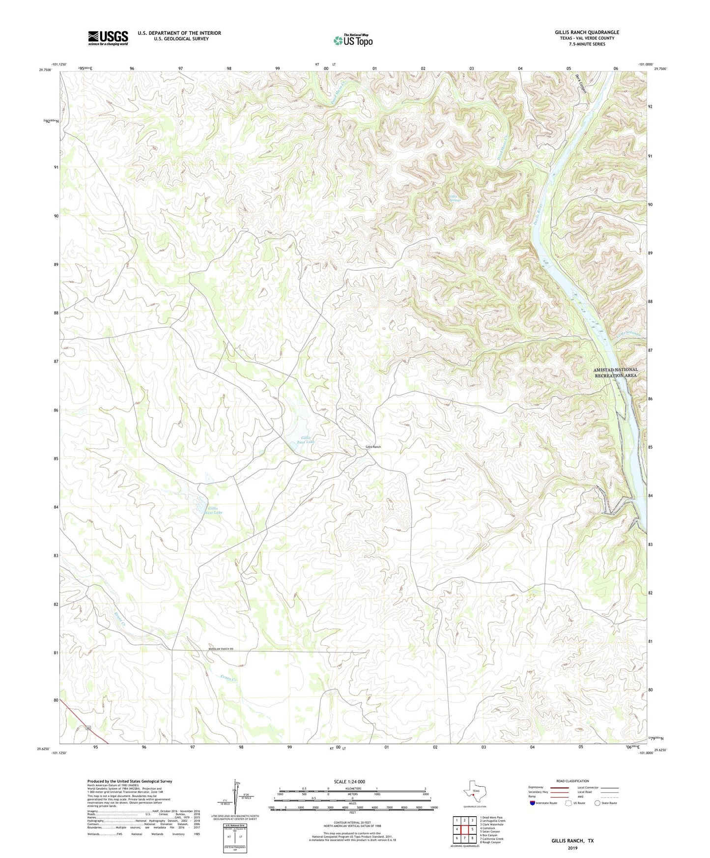
2022 topographic map quadrangle Gillis Ranch in the state of Texas. Scale: 1:24000. Based on the newly updated USGS 7.5' US Topo map series, this map is in the following counties: Val Verde. The map contains contour data, water features, and other items you are used to seeing on USGS maps, but also has updated roads and other features. This is the next generation of topographic maps. Printed on high-quality waterproof paper with UV fade-resistant inks.
Quads adjacent to this one:
West: Comstock
Northwest: Dead Mans Pass
North: Lechuguilla Creek
Northeast: Clark Waterhole
East: Satan Canyon
Southeast: Rough Canyon
South: California Creek
Southwest: Box Canyon
This map covers the same area as the classic USGS quad with code o29101f1.
Contains the following named places: Dark Canyon, Dead Mans Creek, Gillis East Lake, Gillis East Lake Dam, Gillis Ranch, Gillis Springs, Gillis West Lake, Gillis West Lake Dam, Little Satan Creek, Pafford Crossing, Rubboard Crossing