MyTopo
Brady SW Texas US Topo Map
Couldn't load pickup availability
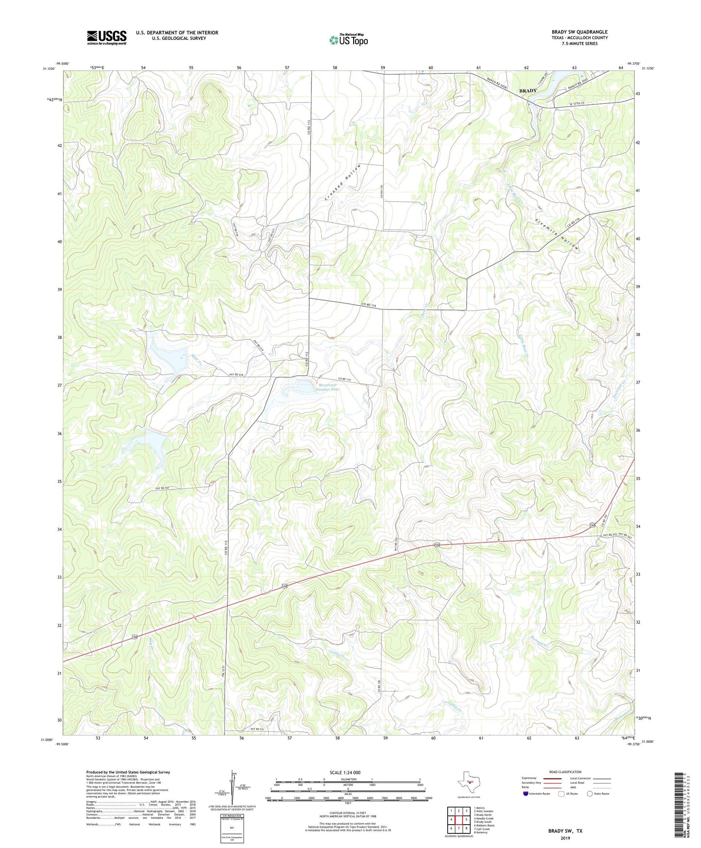
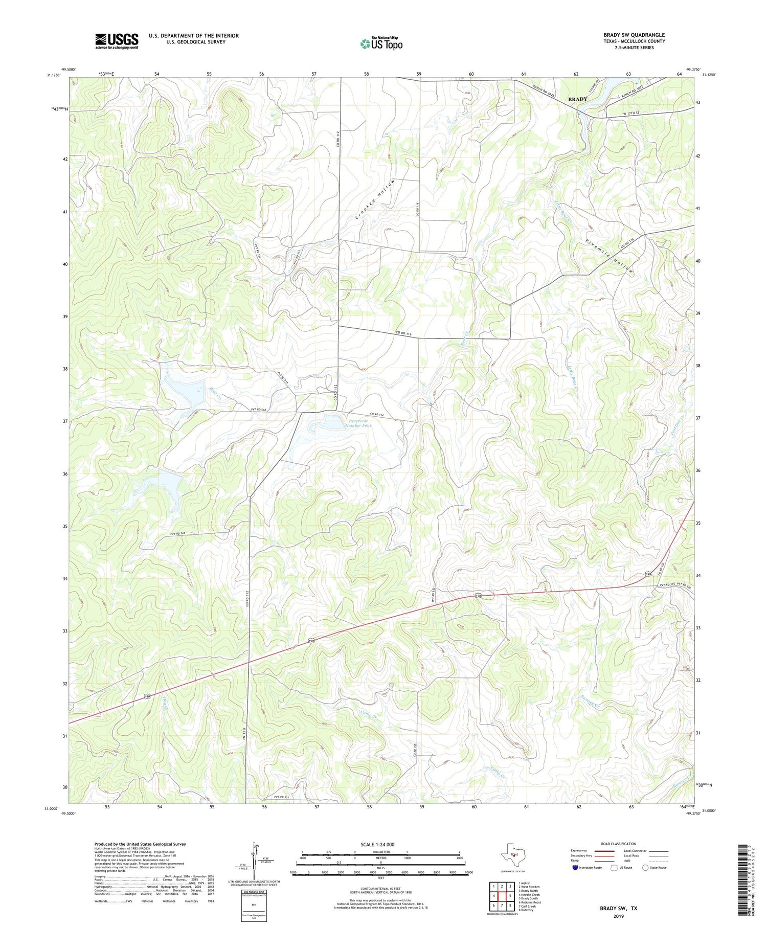
2019 topographic map quadrangle Brady SW in the state of Texas. Scale: 1:24000. Based on the newly updated USGS 7.5' US Topo map series, this map is in the following counties: McCulloch. The map contains contour data, water features, and other items you are used to seeing on USGS maps, but also has updated roads and other features. This is the next generation of topographic maps. Printed on high-quality waterproof paper with UV fade-resistant inks.
Quads adjacent to this one:
West: Needle Creek
Northwest: Melvin
North: West Sweden
Northeast: Brady North
East: Brady South
Southeast: Katemcy
South: Calf Creek
Southwest: Robbers Roost
Contains the following named places: Blue Well Windmill, Bridge Windmill, Double Well Windmill, Fivemile Hollow, Herbert Windmill, Little Bear Creek, Number One Windmill, Number Two Windmill, Pen Windmill, Reservoir Number Five, Reservoir Number Four, Reservoir Number Six, Soil Conservation Service Site 4 Dam, Soil Conservation Service Site 5 Dam, Soil Conservation Service Site 6 Dam, Soil Conservation Service Site 6 Reservoir, South Pasture Windmill, Sulphur Windmill, Truman Windmill, ZIP Code: 76825