
MyTopo
Brazoria Texas US Topo Map
Couldn't load pickup availability
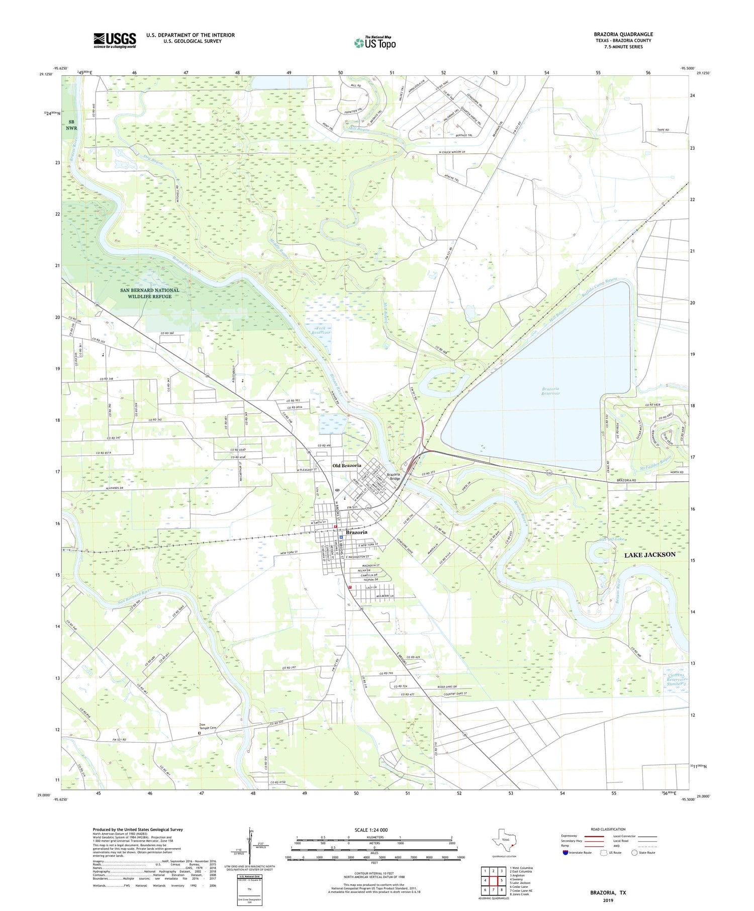
2019 topographic map quadrangle Brazoria in the state of Texas. Scale: 1:24000. Based on the newly updated USGS 7.5' US Topo map series, this map is in the following counties: Brazoria. The map contains contour data, water features, and other items you are used to seeing on USGS maps, but also has updated roads and other features. This is the next generation of topographic maps. Printed on high-quality waterproof paper with UV fade-resistant inks.
Quads adjacent to this one:
West: Sweeny
Northwest: West Columbia
North: East Columbia
Northeast: Angleton
East: Lake Jackson
Southeast: Jones Creek
South: Cedar Lane NE
Southwest: Cedar Lane
Contains the following named places: Barrow Elementary School, Brazoria, Brazoria Bridge, Brazoria City Hall, Brazoria City Park, Brazoria City Reservoir, Brazoria City Reservoir Levee, Brazoria Fire Department, Brazoria Fire Department Station 2, Brazoria Intermediate School, Brazoria Police Department, Brazoria Post Office, Brazoria Reservoir, Brazoria Reservoir Dam, Brazoria Volunteer Fire Department, City of Brazoria, Clemens Reservoir Number 2, Clemens Reservoir Number 2 Levee, Cut-Off Lake, Dacus Lake, Dacus Lake Dam, Dry Bayou, Fontaine Levee, Horseshoe Lake, Middle Bayou, Mill Bayou, Mims School, Old Brazoria, Saint Paul Mission, West Brazos Junior High School, Wild Peach, Wild Peach Elementary School, York Reservoir, Zion Temple Cemetery


