MyTopo
Cedar Lane NE Texas US Topo Map
Couldn't load pickup availability
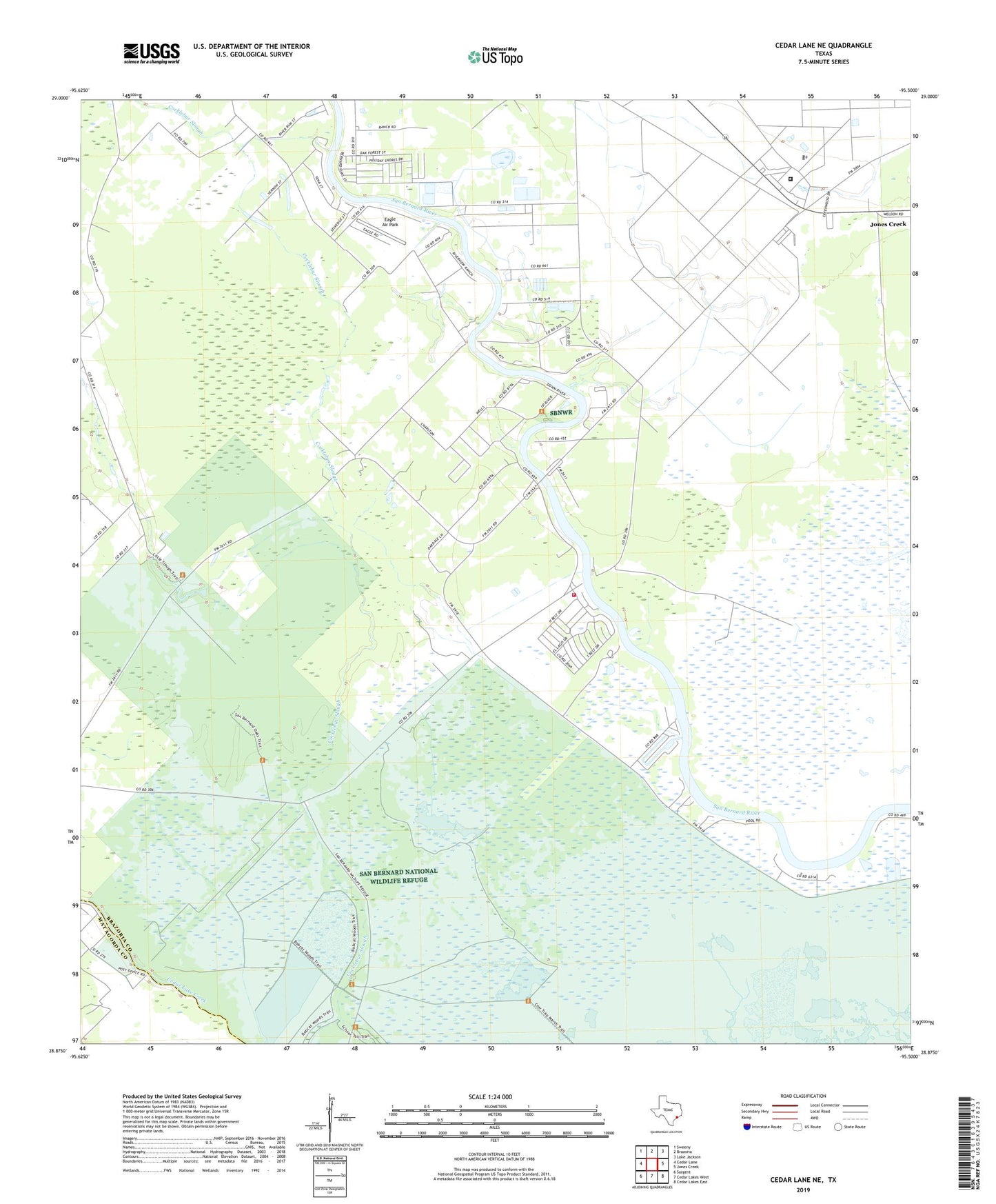
2022 topographic map quadrangle Cedar Lane NE in the state of Texas. Scale: 1:24000. Based on the newly updated USGS 7.5' US Topo map series, this map is in the following counties: Brazoria, Matagorda. The map contains contour data, water features, and other items you are used to seeing on USGS maps, but also has updated roads and other features. This is the next generation of topographic maps. Printed on high-quality waterproof paper with UV fade-resistant inks.
Quads adjacent to this one:
West: Cedar Lane
Northwest: Sweeny
North: Brazoria
Northeast: Lake Jackson
East: Jones Creek
Southeast: Cedar Lakes East
South: Cedar Lakes West
Southwest: Sargent
This map covers the same area as the classic USGS quad with code o28095h5.
Contains the following named places: Churchill, Eagle Air Park, Ellerslie Plantation, Galilee Church, Hinkles Ferry, Jerusalem School, John McCroskey Cabin, Rivers End Volunteer Fire Department Station 2, San Bernard National Wildlife Refuge, Texas Department of Criminal Justice Clemens Unit, ZIP Code: 77422