MyTopo
Cedar Lane Texas US Topo Map
Couldn't load pickup availability
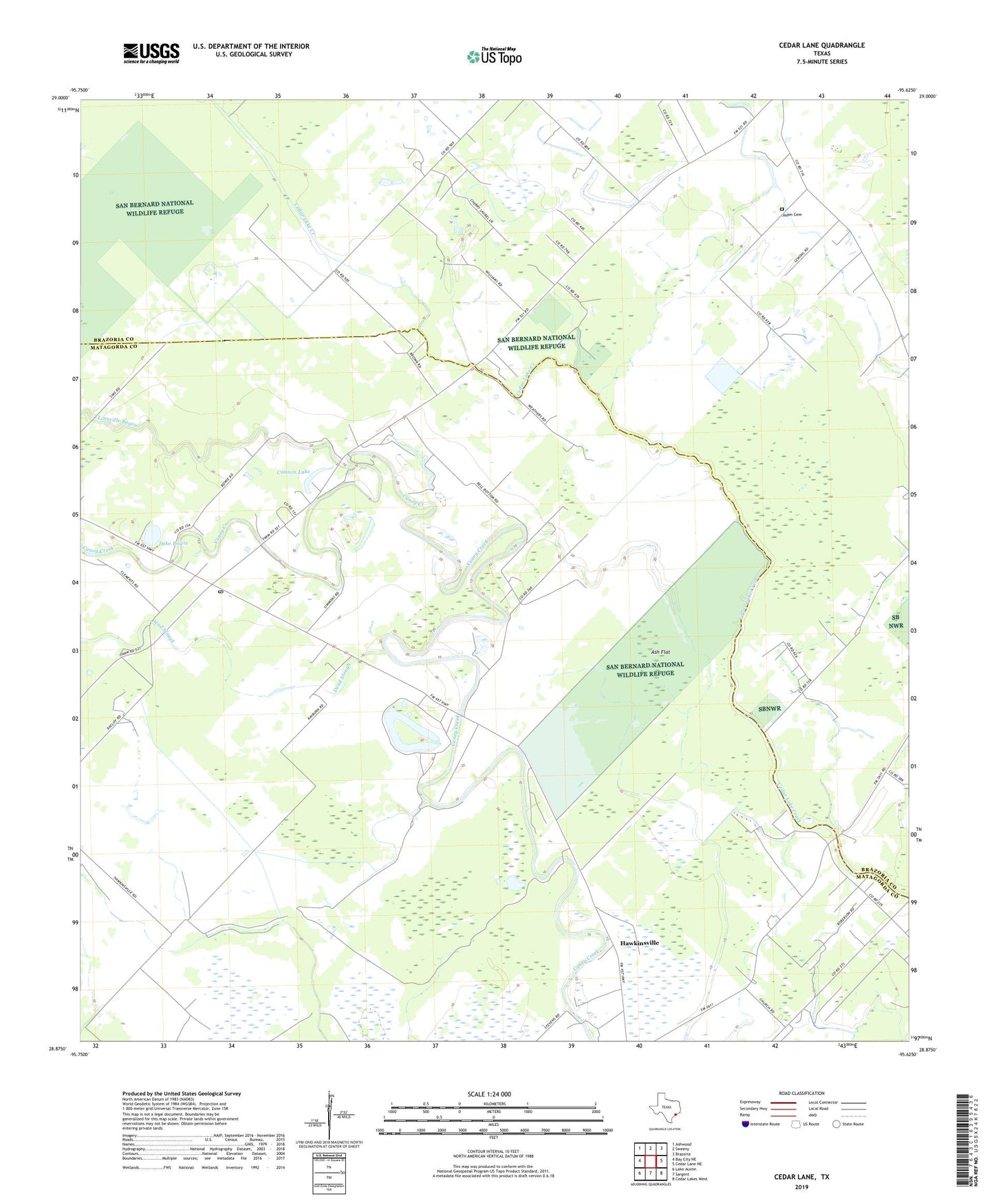
2022 topographic map quadrangle Cedar Lane in the state of Texas. Scale: 1:24000. Based on the newly updated USGS 7.5' US Topo map series, this map is in the following counties: Matagorda, Brazoria. The map contains contour data, water features, and other items you are used to seeing on USGS maps, but also has updated roads and other features. This is the next generation of topographic maps. Printed on high-quality waterproof paper with UV fade-resistant inks.
Quads adjacent to this one:
West: Bay City NE
Northwest: Ashwood
North: Sweeny
Northeast: Brazoria
East: Cedar Lane NE
Southeast: Cedar Lakes West
South: Sargent
Southwest: Lake Austin
This map covers the same area as the classic USGS quad with code o28095h6.
Contains the following named places: Ash Flat, Cannon Lake, Cedar Lake, Cedar Lane, Cedar Lane Post Office, Dead Slough, Gainesmore, Grace Church, Hawkinsville, Jaden Cemetery, Kennedy School, Lake Bowie, Linnville Bayou, Macedonia Church, Magnolia School, Saint Mark Church, Saint Paul Church, Williams Lake, ZIP Code: 77415