MyTopo
Jones Creek Texas US Topo Map
Couldn't load pickup availability
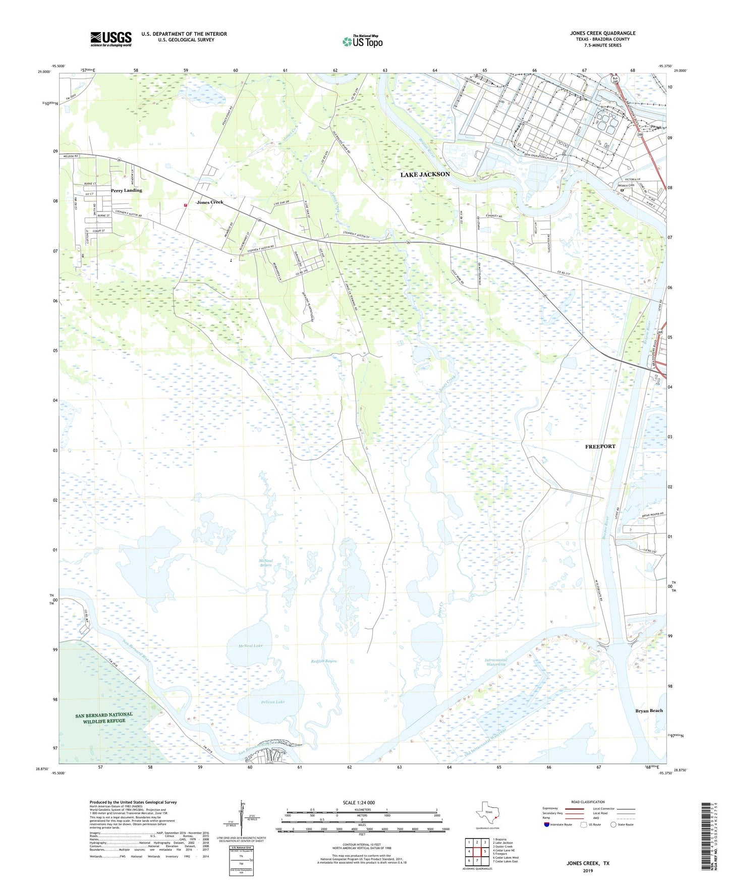
2022 topographic map quadrangle Jones Creek in the state of Texas. Scale: 1:24000. Based on the newly updated USGS 7.5' US Topo map series, this map is in the following counties: Brazoria. The map contains contour data, water features, and other items you are used to seeing on USGS maps, but also has updated roads and other features. This is the next generation of topographic maps. Printed on high-quality waterproof paper with UV fade-resistant inks.
Quads adjacent to this one:
West: Cedar Lane NE
Northwest: Brazoria
North: Lake Jackson
Northeast: Oyster Creek
East: Freeport
South: Cedar Lakes East
Southwest: Cedar Lakes West
This map covers the same area as the classic USGS quad with code o28095h4.
Contains the following named places: Austin School, Brazos River, Bryan Beach, Bryan Mound, Calvary Church, Durazno Plantation, Eastern Branch Church, Flag Lake Drainage Canal, Gulf Park, Gulf Prairie Church, Jones Creek, Jones Creek Marshal's Office, Jones Creek Volunteer Fire Department, Jones Lake, McNeal Bayou, McNeal Lake, Oakland, Old Intracoastal Waterway, Pelican Lake, Perry Landing, Redfish Bayou, Saint Joseph Church, Stephen F Austin Elementary School, Velasco Cemetery, Village of Jones Creek