
MyTopo
Brookshire Texas US Topo Map
Couldn't load pickup availability
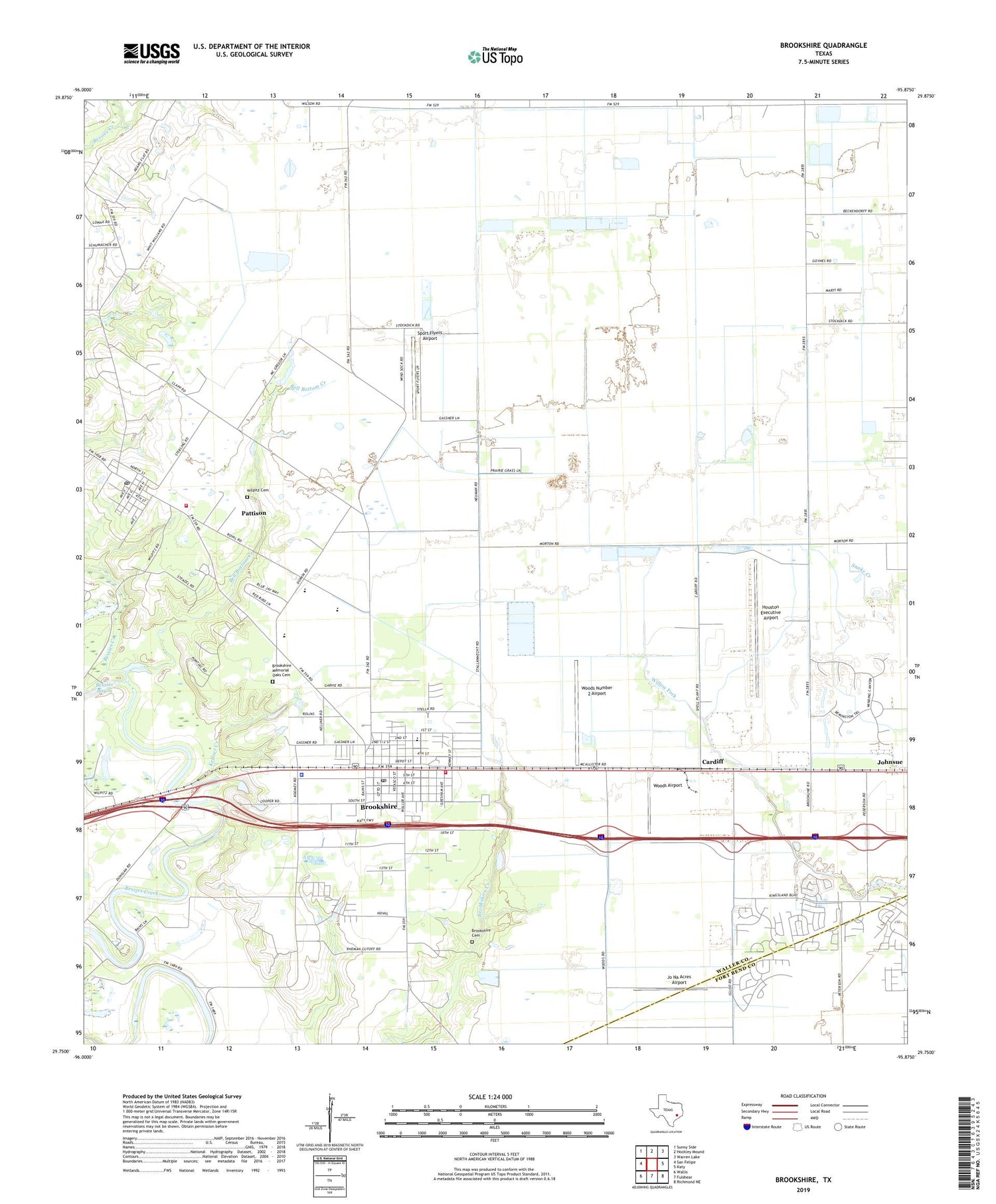
2019 topographic map quadrangle Brookshire in the state of Texas. Scale: 1:24000. Based on the newly updated USGS 7.5' US Topo map series, this map is in the following counties: Waller, Fort Bend. The map contains contour data, water features, and other items you are used to seeing on USGS maps, but also has updated roads and other features. This is the next generation of topographic maps. Printed on high-quality waterproof paper with UV fade-resistant inks.
Quads adjacent to this one:
West: San Felipe
Northwest: Sunny Side
North: Hockley Mound
Northeast: Warren Lake
East: Katy
Southeast: Richmond NE
South: Fulshear
Southwest: Wallis
Contains the following named places: Apostolic Church, Bell Bottom Creek, Brookshire, Brookshire - Pattison Area Emergency Medical Service, Brookshire Auxiliary Fire Department, Brookshire Cemetery, Brookshire City Hall, Brookshire Community Church, Brookshire Division, Brookshire Memorial Oaks Cemetery, Brookshire Police Department, Brookshire Post Office, Brookshire Volunteer Fire Department, Cardiff, City of Brookshire, City of Pattison, Curry Chapel Baptist Church, Currys Chapel, First Baptist Church, Houston Executive Airport, Jo Na Acres Airport, Johnsue, Kellner Creek, Mount Zion Baptist Church, Pattison, Pattison Area Volunteer Fire Department, Pattison City Offices, Pattison Post Office, Royal High School, Royal Middle School, Royal School, Sport Flyers Airport, Waller County Constable's Office Precinct 4, Waller County Emergency Services, Waller County Historical Museum, Wilpitz Cemetery, Woods Airport, Woods Number 2 Airport, ZIP Code: 77423


