MyTopo
Warren Lake Texas US Topo Map
Couldn't load pickup availability
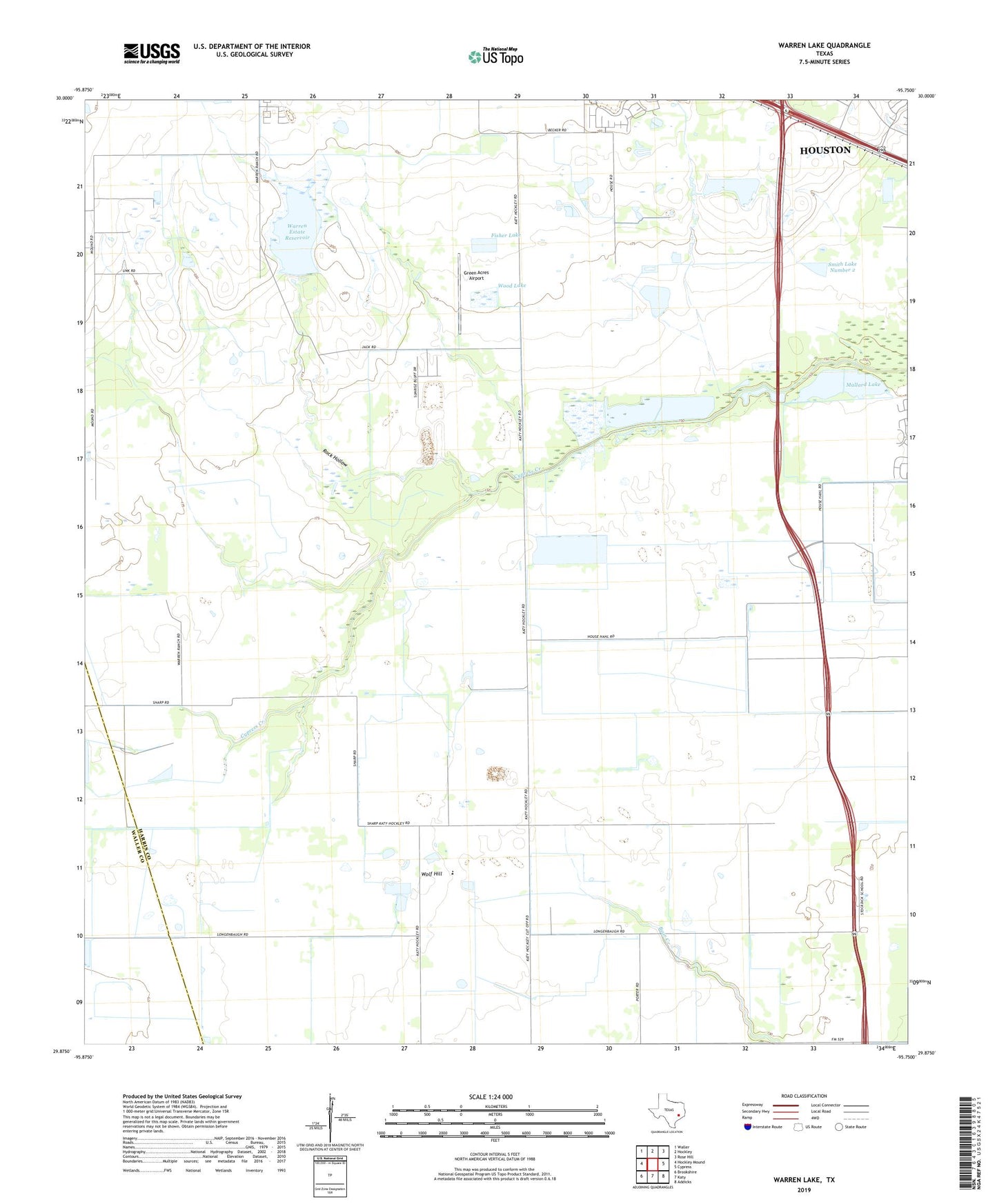
2022 topographic map quadrangle Warren Lake in the state of Texas. Scale: 1:24000. Based on the newly updated USGS 7.5' US Topo map series, this map is in the following counties: Harris, Waller. The map contains contour data, water features, and other items you are used to seeing on USGS maps, but also has updated roads and other features. This is the next generation of topographic maps. Printed on high-quality waterproof paper with UV fade-resistant inks.
Quads adjacent to this one:
West: Hockley Mound
Northwest: Waller
North: Hockley
Northeast: Rose Hill
East: Cypress
Southeast: Addicks
South: Katy
Southwest: Brookshire
This map covers the same area as the classic USGS quad with code o29095h7.
Contains the following named places: Chudleigh Farms Dam Number 1, Chudleigh Farms Dam Number 2, Chudleigh Farms Lake Number 1, Chudleigh Farms Lake Number 2, Fisher Lake, Fisher Lake Dam, Green Acres Airport, Harold Freeman Farm Airport, House Lake, House Lake Dam, Longenbaugh Levee, Mallard Lake, Mallard Lakes, Rock Hollow, Sack-O-Grande Acroport Airport, Smith Lake Number 1, Smith Lake Number 1 Dam, Smith Lake Number 2, Smith Lake Number 2 Dam, Smith Lake Number 3, Smith Lake Number 3 Dam, Warren Estate Reservoir, Warren Estate Reservoir Dam, Warren Lake, Warren Ranch, Wolf Hill, Wood Lake, Wood Lake Dam