MyTopo
Sunny Side Texas US Topo Map
Couldn't load pickup availability
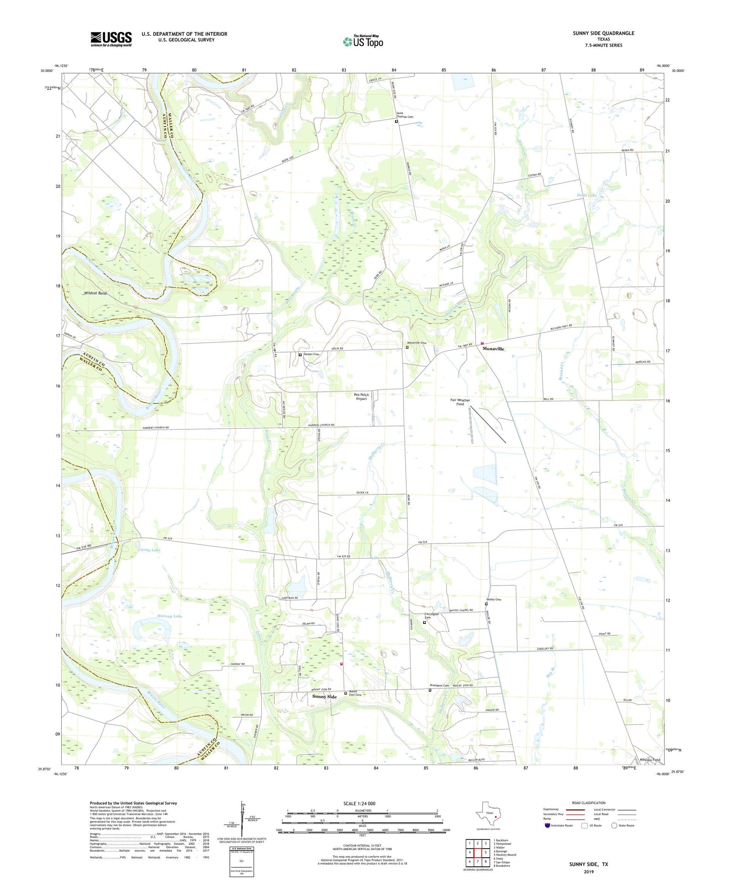
2022 topographic map quadrangle Sunny Side in the state of Texas. Scale: 1:24000. Based on the newly updated USGS 7.5' US Topo map series, this map is in the following counties: Waller, Austin. The map contains contour data, water features, and other items you are used to seeing on USGS maps, but also has updated roads and other features. This is the next generation of topographic maps. Printed on high-quality waterproof paper with UV fade-resistant inks.
Quads adjacent to this one:
West: Burleigh
Northwest: Buckhorn
North: Hempstead
Northeast: Waller
East: Hockley Mound
Southeast: Brookshire
South: San Felipe
Southwest: Sealy
This map covers the same area as the classic USGS quad with code o29096h1.
Contains the following named places: Beef Bayou, Carrington Cemetery, Clear Creek, Cunny Lake, Dodd Lake, Dodd Lake Dam, Fair Weather Field, Hannay Lake, Harper Cemetery, Harper Church, Harris Creek, Harris Creek Church, Monaville, Monaville Cemetery, Monaville Volunteer Fire Department Station 2, Mount Zion Cemetery, Mount Zion Church, Mount Zion Community Fire Company, Mulberry Creek, Palmer Lake, Pea Patch Airport, President Cemetery, Saint Thomas Cemetery, Saint Thomas Church, Sunny Side, Sunny Side Post Office, Vesley Cemetery, Waller County Emergency Medical Services, Wildcat Bend