MyTopo
Bruceville Texas US Topo Map
Couldn't load pickup availability
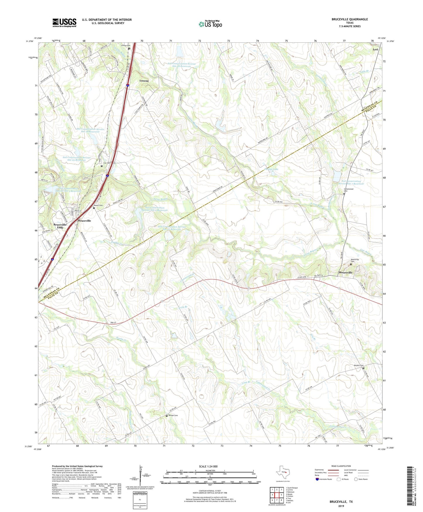
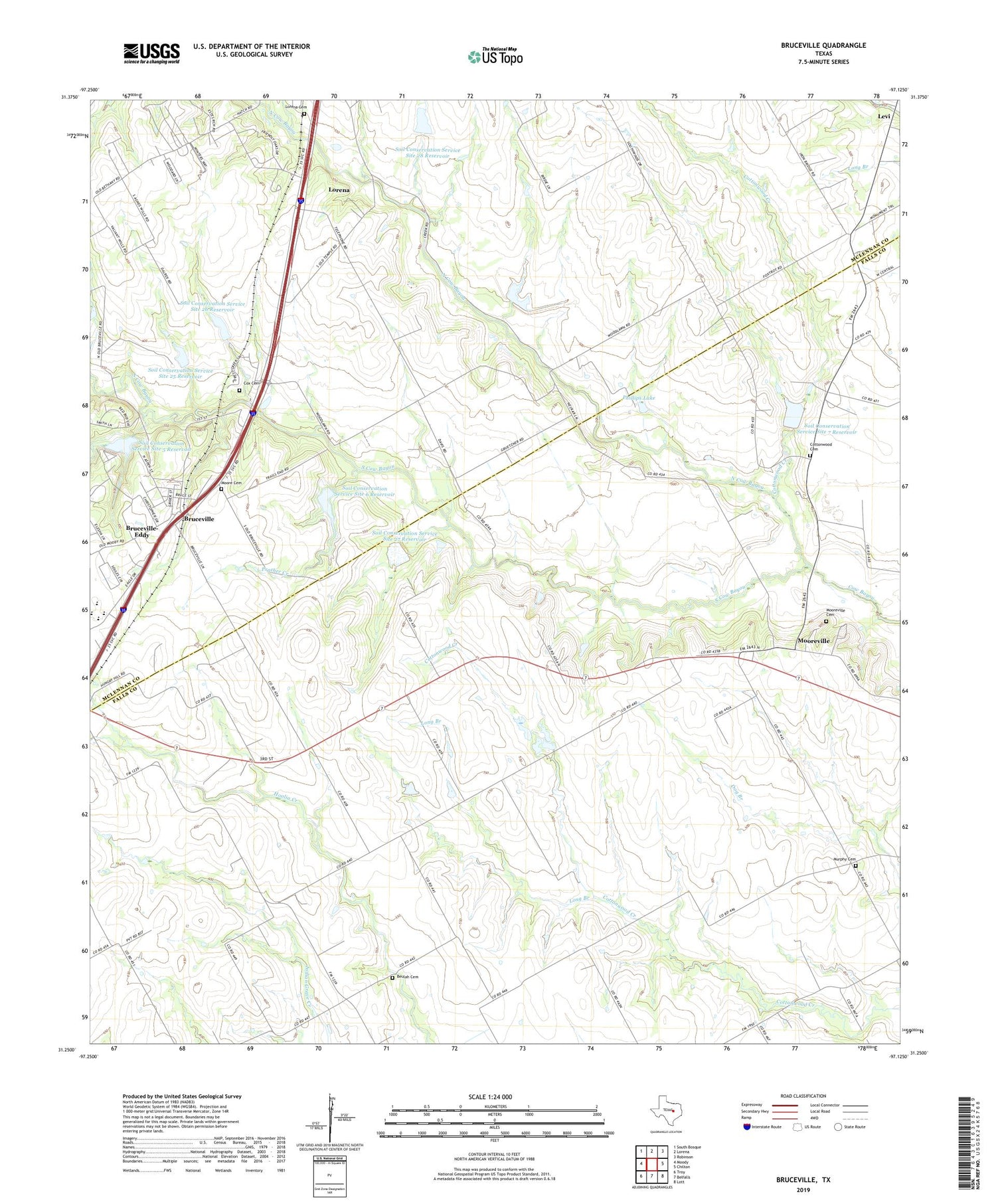
2019 topographic map quadrangle Bruceville in the state of Texas. Scale: 1:24000. Based on the newly updated USGS 7.5' US Topo map series, this map is in the following counties: Falls, McLennan. The map contains contour data, water features, and other items you are used to seeing on USGS maps, but also has updated roads and other features. This is the next generation of topographic maps. Printed on high-quality waterproof paper with UV fade-resistant inks.
Quads adjacent to this one:
West: Moody
Northwest: South Bosque
North: Lorena
Northeast: Robinson
East: Chilton
Southeast: Lott
South: Belfalls
Southwest: Troy
Contains the following named places: Beulah Cemetery, Bruceville, Bruceville - Eddy City Hall, Bruceville - Eddy Emergency Medical Services, Bruceville - Moore Cemetery, Bruceville-Eddy Elementary School, Bruceville-Eddy High School, City of Bruceville-Eddy, Cottonwood Cemetery, Cottonwood Church, Cottonwood Creek, Cottonwood School, Cox Cemetery, KCEN-TV (Temple), Long Branch, Lorena Cemetery, Lusk Branch, Mooreville, Mooreville Cemetery, Murphy Cemetery, North Cow Bayou, Phillips Dam, Phillips Lake, Prather Creek, Sisk Reunion Park, Soil Conservation Service Site 25 Dam, Soil Conservation Service Site 25 Reservoir, Soil Conservation Service Site 26 Dam, Soil Conservation Service Site 26 Reservoir, Soil Conservation Service Site 27 Dam, Soil Conservation Service Site 27 Reservoir, Soil Conservation Service Site 28 Dam, Soil Conservation Service Site 28 Reservoir, Soil Conservation Service Site 5 Dam, Soil Conservation Service Site 5 Reservoir, Soil Conservation Service Site 6 Dam, Soil Conservation Service Site 6 Reservoir, Soil Conservation Service Site 7 Dam, Soil Conservation Service Site 7 Reservoir, South Cow Bayou, ZIP Codes: 76524, 76630