MyTopo
Chilton Texas US Topo Map
Couldn't load pickup availability
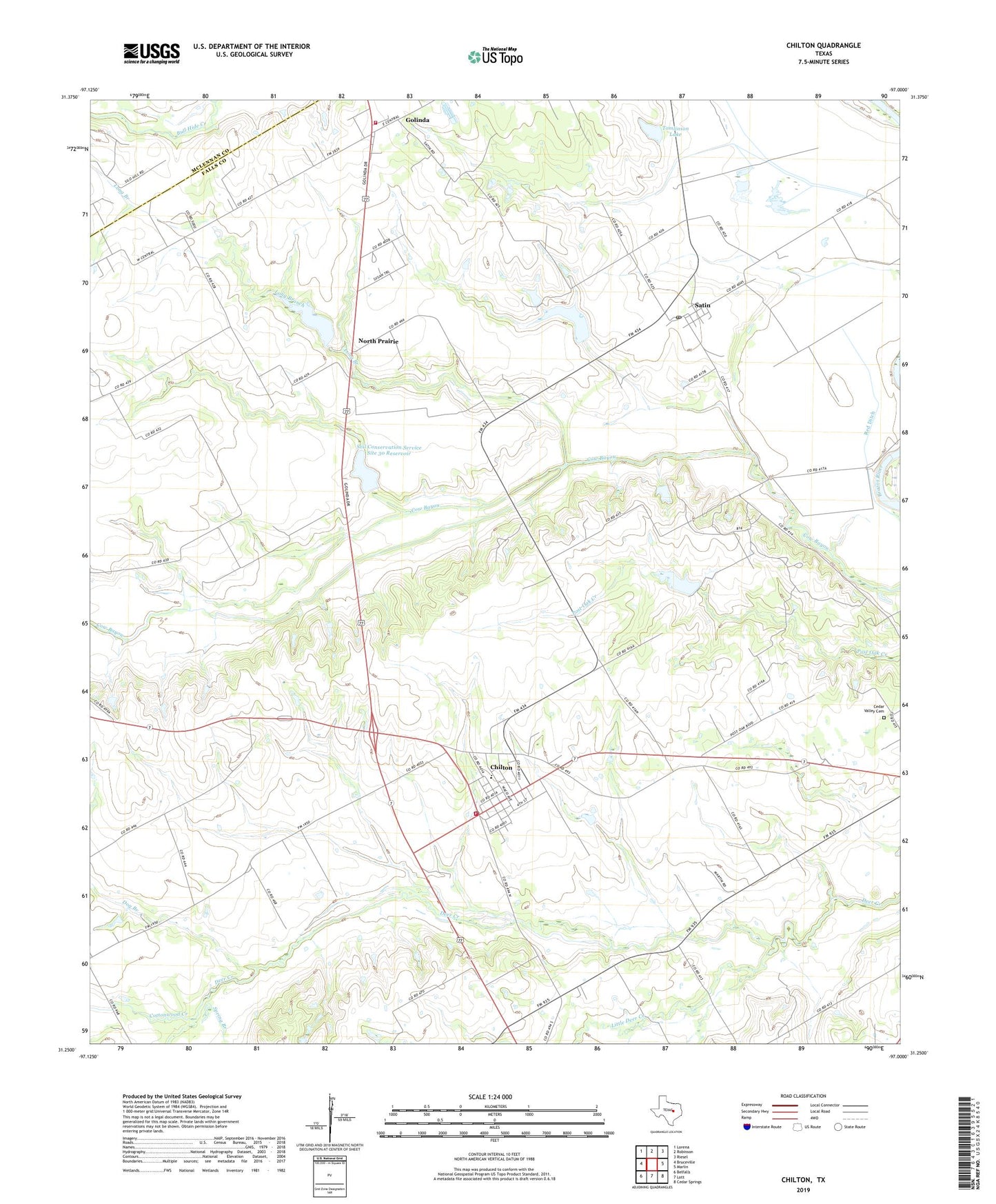
2022 topographic map quadrangle Chilton in the state of Texas. Scale: 1:24000. Based on the newly updated USGS 7.5' US Topo map series, this map is in the following counties: Falls, McLennan. The map contains contour data, water features, and other items you are used to seeing on USGS maps, but also has updated roads and other features. This is the next generation of topographic maps. Printed on high-quality waterproof paper with UV fade-resistant inks.
Quads adjacent to this one:
West: Bruceville
Northwest: Lorena
North: Robinson
Northeast: Riesel
East: Marlin
Southeast: Cedar Springs
South: Lott
Southwest: Belfalls
This map covers the same area as the classic USGS quad with code o31097c1.
Contains the following named places: Cedar Valley Cemetery, Cedar Valley Church, Chilton, Chilton Census Designated Place, Chilton Division, Chilton Post Office, Chilton Volunteer Fire Department, City of Golinda, Cottonwood Creek, Deer Creek Oil Field, Dog Branch, Dott, Golinda City Hall, Golinda Volunteer Fire Department, Guda, Little Deer Creek, Little Deer Creek Church, Long Branch, North Prairie, Post Oak Oil Field, Red Ditch, Satin, Satin Post Office, Soil Conservation Service Site 15 Dam, Soil Conservation Service Site 15 Reservoir, Soil Conservation Service Site 16 Dam, Soil Conservation Service Site 16 Reservoir, Soil Conservation Service Site 29 Dam, Soil Conservation Service Site 29 Reservoir, Soil Conservation Service Site 30 Dam, Soil Conservation Service Site 30 Reservoir, Spring Branch, Tomlinson Lake, Tomlinson Lake Dam, ZIP Codes: 76632, 76685