MyTopo
Troy Texas US Topo Map
Couldn't load pickup availability
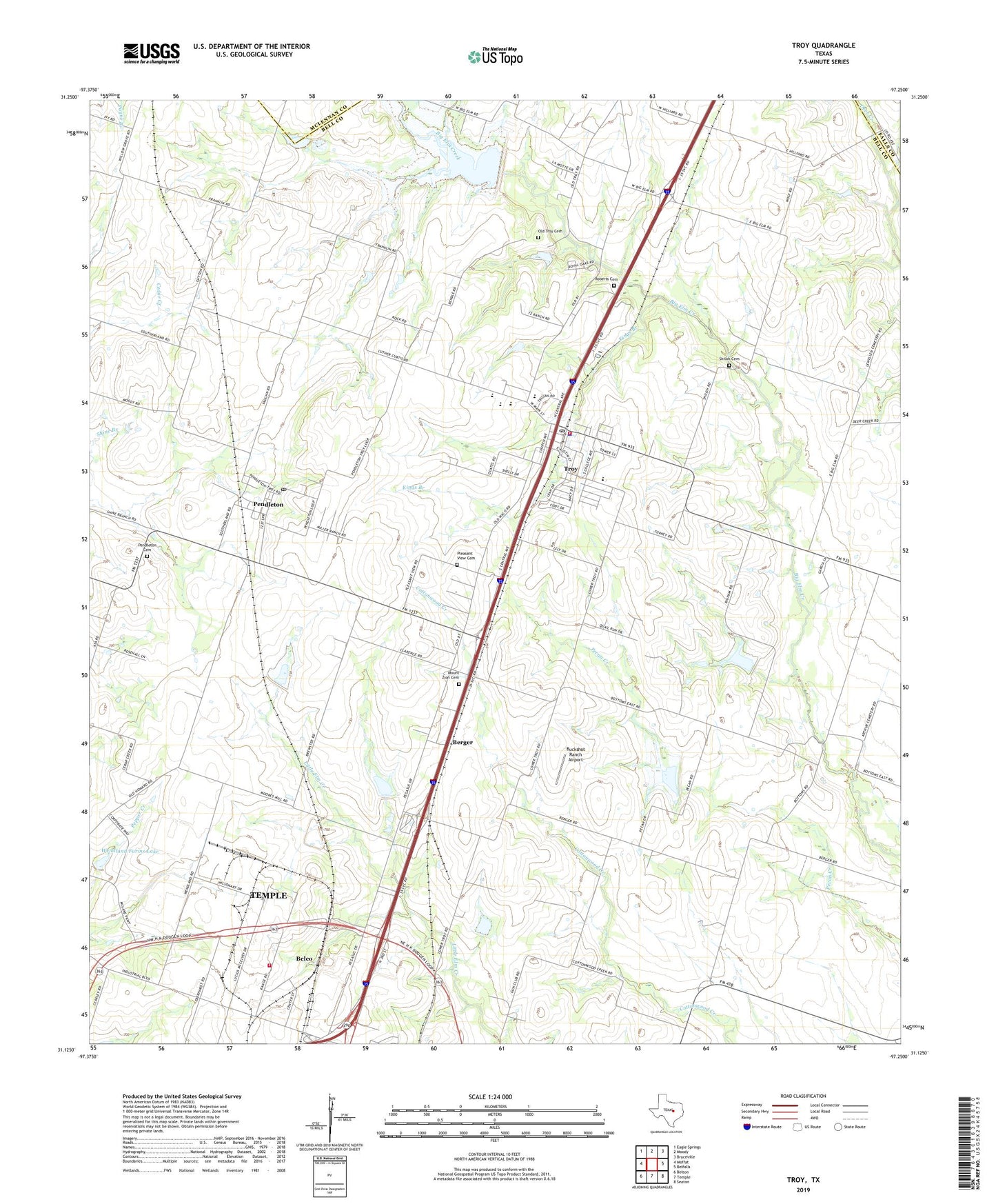
2022 topographic map quadrangle Troy in the state of Texas. Scale: 1:24000. Based on the newly updated USGS 7.5' US Topo map series, this map is in the following counties: Bell, McLennan, Falls. The map contains contour data, water features, and other items you are used to seeing on USGS maps, but also has updated roads and other features. This is the next generation of topographic maps. Printed on high-quality waterproof paper with UV fade-resistant inks.
Quads adjacent to this one:
West: Moffat
Northwest: Eagle Springs
North: Moody
Northeast: Bruceville
East: Belfalls
Southeast: Seaton
South: Temple
Southwest: Belton
This map covers the same area as the classic USGS quad with code o31097b3.
Contains the following named places: Belco, Berger, Buckshot Ranch Airport, City of Troy, First Baptist Church, Grace Baptist Church, Kings Branch, Mount Zion Cemetery, Northside Church of Christ, Old Troy Cemetery, Pendleton, Pendleton Cemetery, Pendleton Census Designated Place, Pendleton Post Office, Pleasant View Cemetery, Roberts Cemetery, Shiloh Cemetery, Temple Fire and Rescue Station 6, Troy, Troy City Hall, Troy Elementary School, Troy First Assembly of God Church, Troy High School, Troy Middle School, Troy Police Department, Troy Post Office, Troy Volunteer Fire Department, Wendland Farms Lake, Wendland Farms Lake Dam, Willow Grove Church, ZIP Codes: 76504, 76579