MyTopo
Buckhorn Mountain Texas US Topo Map
Couldn't load pickup availability
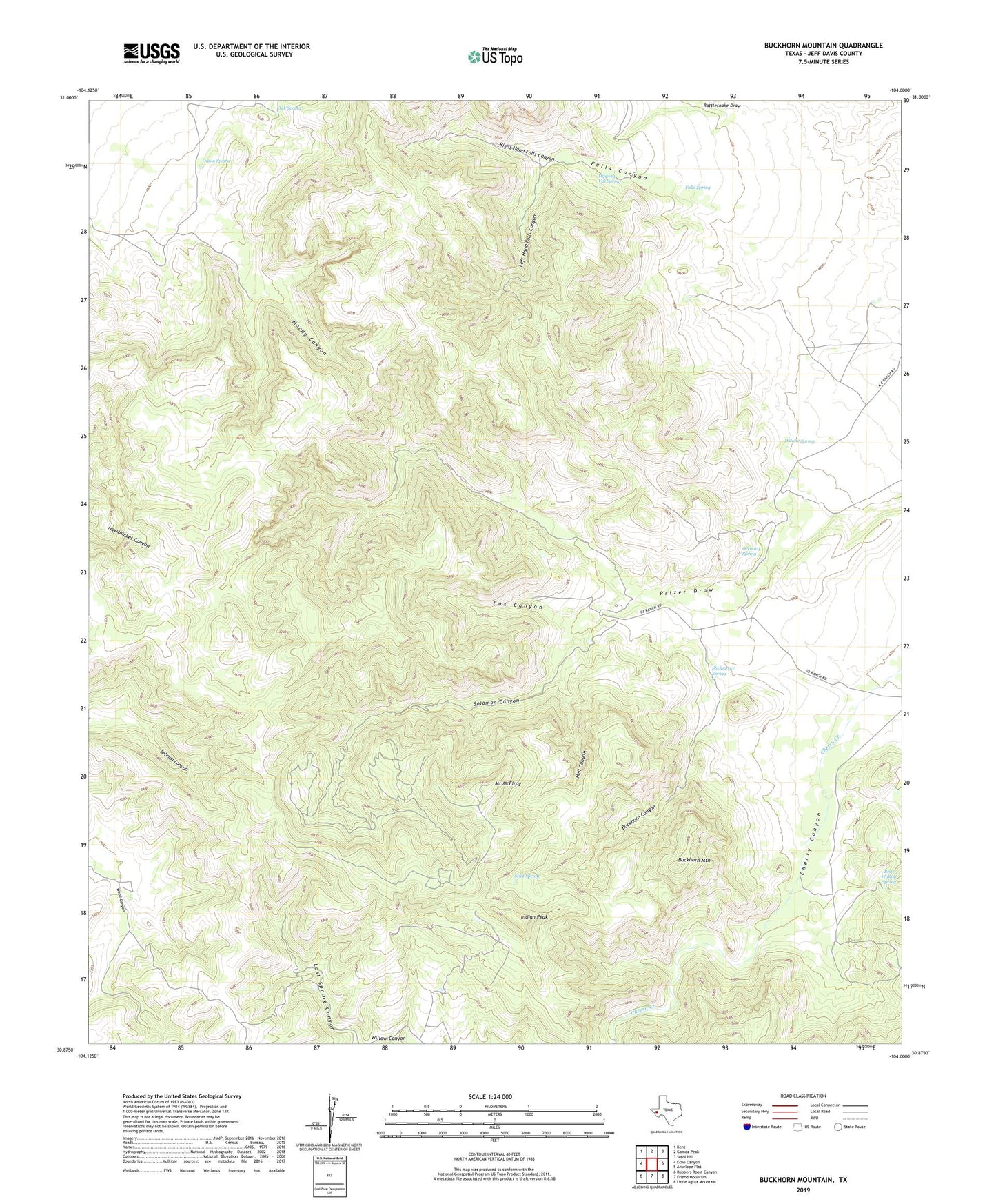
2019 topographic map quadrangle Buckhorn Mountain in the state of Texas. Scale: 1:24000. Based on the newly updated USGS 7.5' US Topo map series, this map is in the following counties: Jeff Davis. The map contains contour data, water features, and other items you are used to seeing on USGS maps, but also has updated roads and other features. This is the next generation of topographic maps. Printed on high-quality waterproof paper with UV fade-resistant inks.
Quads adjacent to this one:
West: Echo Canyon
Northwest: Kent
North: Gomez Peak
Northeast: Sotol Hill
East: Antelope Flat
Southeast: Little Aguja Mountain
South: Friend Mountain
Southwest: Robbers Roost Canyon
Contains the following named places: Bear Wallow Spring, Buckhorn Canyon, Buckhorn Mountain, Cherry Canyon, Cherry Canyon Ranch, Dipping Vat Spring, Falls Canyon, Falls Spring, Fox Canyon, Gomez Windmill, Hell Canyon, Indian Peak, K C Ranch, Left Hand Falls Canyon, Leonard Camp Windmill, Moody Canyon, Mount McElroy, Mud Spring, Oak Spring, Onion Spring, Orchard Spring, Prizer Draw, Right Hand Falls Canyon, Shelbarger Spring, Sierra Windmill, Solomon Canyon, Willow Spring, Wood Canyon Well, Zero Three Ranch