MyTopo
Robbers Roost Canyon Texas US Topo Map
Couldn't load pickup availability
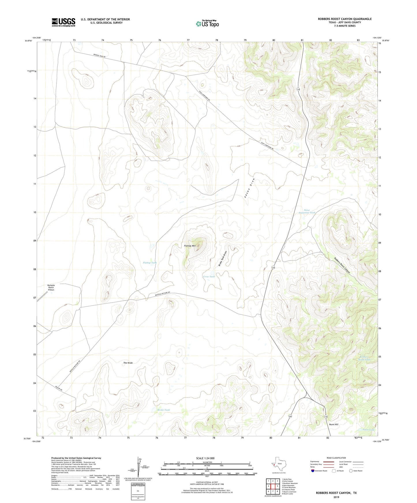
2022 topographic map quadrangle Robbers Roost Canyon in the state of Texas. Scale: 1:24000. Based on the newly updated USGS 7.5' US Topo map series, this map is in the following counties: Jeff Davis. The map contains contour data, water features, and other items you are used to seeing on USGS maps, but also has updated roads and other features. This is the next generation of topographic maps. Printed on high-quality waterproof paper with UV fade-resistant inks.
Quads adjacent to this one:
West: Bare Mountain
Northwest: Herds Pass
North: Echo Canyon
Northeast: Buckhorn Mountain
East: Friend Mountain
Southeast: Mount Locke
South: Mount Livermore
Southwest: El Muerto Peak
This map covers the same area as the classic USGS quad with code o30104g2.
Contains the following named places: Broke Tank, Broke Tank Draw, Buffalo Windmill, Crow Tank, Flattop Mountain, Flattop Tank, High Lonesome Windmill, Nunn Hill, Nunn Tank, Phillips Tank, Robbers Roost Canyon, Robbers Roost Tank, Saint Augustine Tank, The Knob