MyTopo
Gomez Peak Texas US Topo Map
Couldn't load pickup availability
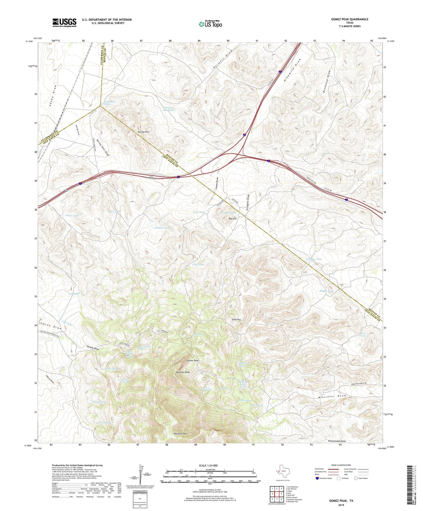
2022 topographic map quadrangle Gomez Peak in the state of Texas. Scale: 1:24000. Based on the newly updated USGS 7.5' US Topo map series, this map is in the following counties: Jeff Davis, Reeves, Culberson. The map contains contour data, water features, and other items you are used to seeing on USGS maps, but also has updated roads and other features. This is the next generation of topographic maps. Printed on high-quality waterproof paper with UV fade-resistant inks.
Quads adjacent to this one:
West: Kent
Northwest: Iron Mountain
North: San Martine
Northeast: Gozar
East: Sotol Hill
Southeast: Antelope Flat
South: Buckhorn Mountain
Southwest: Echo Canyon
This map covers the same area as the classic USGS quad with code o31104a1.
Contains the following named places: Antelope Tank, Arbor Windmill, Bankhead Windmill, Brushy Draw, Canyon Mill Tank, Canyon Windmill, Cherry Spring, Clay Tank, Cold Spring, Cowan Draw, Cowan Homestead, Cowden Ranch, Cox Tank, Deer Camp, Gold Hill, Gomez Peak, Hackberry Spring, Highway Tank, House Spring, Indian Spring, Indian Springs, Lake Windmill, Levinson, Levinson Reservoir Dam, Little Tank, Little Willow Spring, Little Willow Springs, Lower Hidden Spring, Middle Tank, Mud Spring, New Tank, Newman Peak, Pine Spring, Red Hill, Red Hill Tank, Rock Tank, San Martine Spring, Scroggins Draw, Spring Hills, Spring Hills Draw, Stocks Ranch, Stocks Well Number One, Stratton Well, Upper Hidden Spring, Wallace Tank, Walnut Spring, White Tank, Willow Spring, Woodrow Spring, Woulfter Mountain, Woulfter Ranch