MyTopo
Kent Texas US Topo Map
Couldn't load pickup availability
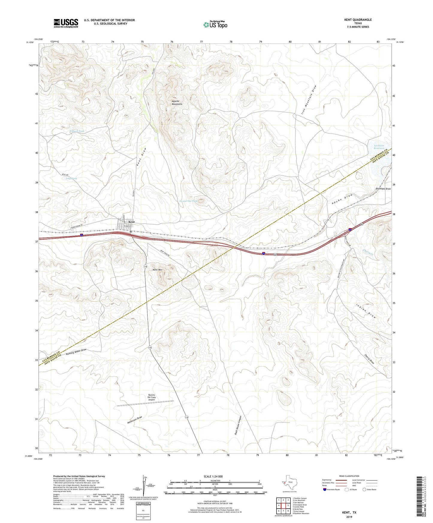
2022 topographic map quadrangle Kent in the state of Texas. Scale: 1:24000. Based on the newly updated USGS 7.5' US Topo map series, this map is in the following counties: Culberson, Jeff Davis. The map contains contour data, water features, and other items you are used to seeing on USGS maps, but also has updated roads and other features. This is the next generation of topographic maps. Printed on high-quality waterproof paper with UV fade-resistant inks.
Quads adjacent to this one:
West: Fencepost Draw
Northwest: Panther Canyon
North: Iron Mountain
Northeast: San Martine
East: Gomez Peak
Southeast: Buckhorn Mountain
South: Echo Canyon
Southwest: Herds Pass
This map covers the same area as the classic USGS quad with code o31104a2.
Contains the following named places: Cherry Creek, Cherry Draw, In and Out Tank, Indian Draw, Irby Tank, Kent, Kent Cemetery, Kent Mountain, Kent Post Office, Levinson Reservoir, Lippy Tank, Patterson Draw, Rancho Del Cielo Airport, Rock House Canyon, Running Water Draw, Tidwell Tank, Twin Bridges