MyTopo
Caiman Creek NE Texas US Topo Map
Couldn't load pickup availability
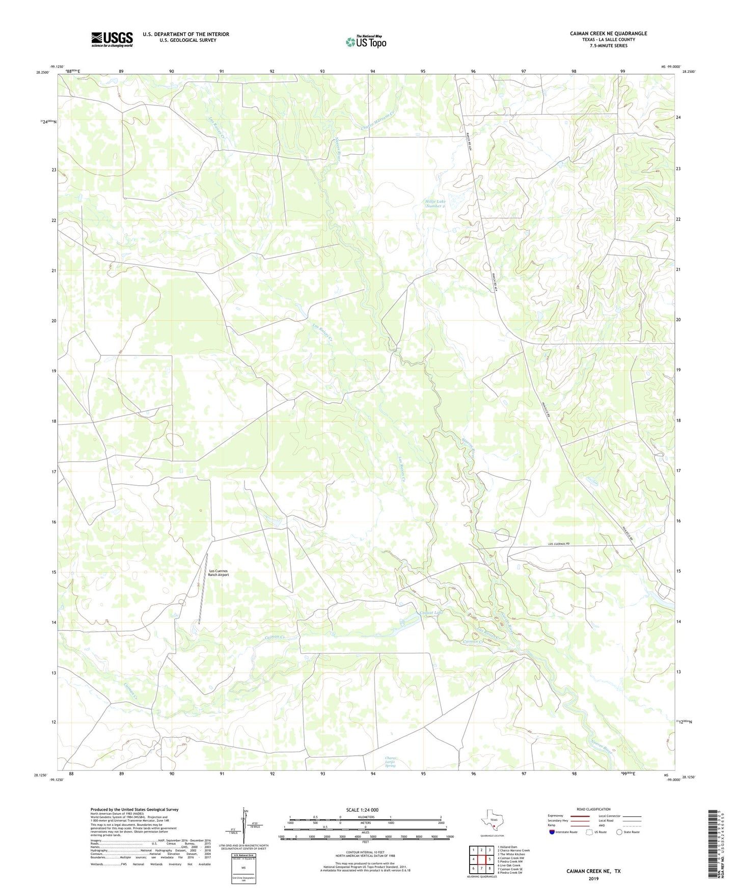
2022 topographic map quadrangle Caiman Creek NE in the state of Texas. Scale: 1:24000. Based on the newly updated USGS 7.5' US Topo map series, this map is in the following counties: La Salle. The map contains contour data, water features, and other items you are used to seeing on USGS maps, but also has updated roads and other features. This is the next generation of topographic maps. Printed on high-quality waterproof paper with UV fade-resistant inks.
Quads adjacent to this one:
West: Caiman Creek NW
Northwest: Holland Dam
North: Charco Marrano Creek
Northeast: The White Kitchen
East: Piedra Creek NW
Southeast: Piedra Creek SW
South: Caiman Creek SE
Southwest: Live Oak Creek
This map covers the same area as the classic USGS quad with code o28099b1.
Contains the following named places: Caiman Creek, Charco Largo Spring, Charco Marrano Creek, Coquat Lake, Coquat Lake Dam, Fort Ewell Historical Monument, Fort Ewell Site, Hillje Dam Number 1, Hillje Lake Number 1, Hillje Lake Number 2, Hillje Lake Number 2 Dam, Las Raices Creek, Los Cuernos Ranch Airport