MyTopo
Chriesman Texas US Topo Map
Couldn't load pickup availability
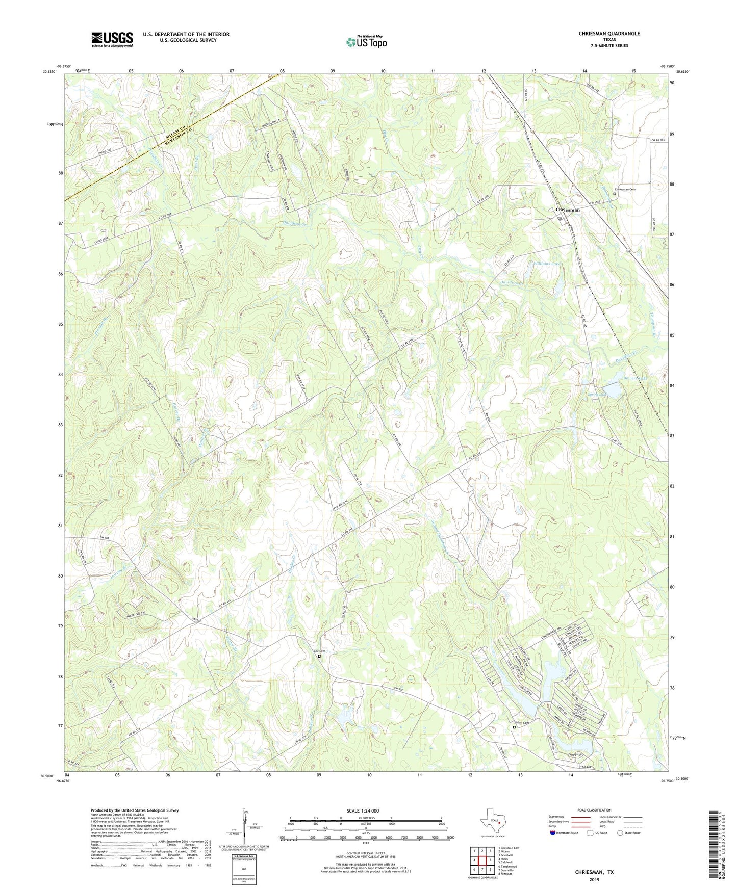
2022 topographic map quadrangle Chriesman in the state of Texas. Scale: 1:24000. Based on the newly updated USGS 7.5' US Topo map series, this map is in the following counties: Burleson, Milam. The map contains contour data, water features, and other items you are used to seeing on USGS maps, but also has updated roads and other features. This is the next generation of topographic maps. Printed on high-quality waterproof paper with UV fade-resistant inks.
Quads adjacent to this one:
West: Hicks
Northwest: Rockdale East
North: Milano
Northeast: Goodwill
East: Caldwell
Southeast: Frenstat
South: Deanville
Southwest: Tanglewood
This map covers the same area as the classic USGS quad with code o30096e7.
Contains the following named places: Bowers Lake, Bowers Lake Dam, Cade Dam Number 3, Cade Lake Number 3, Cade Lakes, Cade Lakes Census Designated Place, Caldwell Division, Chriesman, Chriesman Cemetery, Chriesman Post Office, Cox Cemetery, Dry Creek, East-West Lake, East-West Lake Dam, Frost Branch, Liberty Church, Panther Branch, Shiloh Cemetery, Shiloh School, Spring Lake, Thompson Branch, Williams Lake, Williams Lake Dam