MyTopo
Callo Padrones Texas US Topo Map
Couldn't load pickup availability
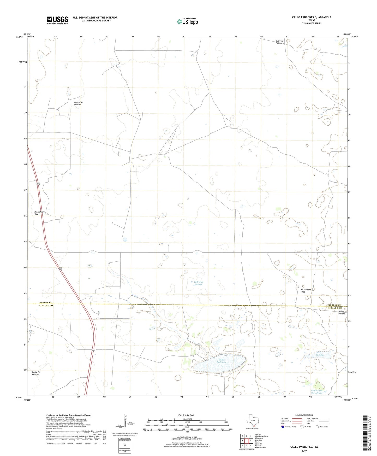
2019 topographic map quadrangle Callo Padrones in the state of Texas. Scale: 1:24000. Based on the newly updated USGS 7.5' US Topo map series, this map is in the following counties: Brooks, Hidalgo. The map contains contour data, water features, and other items you are used to seeing on USGS maps, but also has updated roads and other features. This is the next generation of topographic maps. Printed on high-quality waterproof paper with UV fade-resistant inks.
Quads adjacent to this one:
West: Hartland
Northwest: Encino
North: San Tomas Camp
Northeast: Pita Camp
East: Julian
Southeast: Andrea Ranch
South: Linn NE
Southwest: Linn NW
Contains the following named places: Alameda Windmill, Callo Padrones, Catanes Windmill, Chorro Well, Cuatro Esquinas Windmill, Dos Pilas Windmill, El Aceitero Trap, El Aceitero Well Fiftyone, El Callo, El Naranjo Windmills, Huisaches Altos Ranch, Huisaches Trap, Jassos Gate Windmill, Julian Pasture, La Posita Windmill, Laguna Del Toro Prieto, Lagunitas Windmill, Los Cuates Windmill, Los Cuervos Windmill, Maguelles Pasture, Maguelles Windmill, Padrones Pasture, Padrones Well, Quiteria Pasture, Santa Fe Oil Field, Santa Fe Pasture, Sauceda Windmill, South Santa Fe Oil Field, Viboras Well