MyTopo
Julian Texas US Topo Map
Couldn't load pickup availability
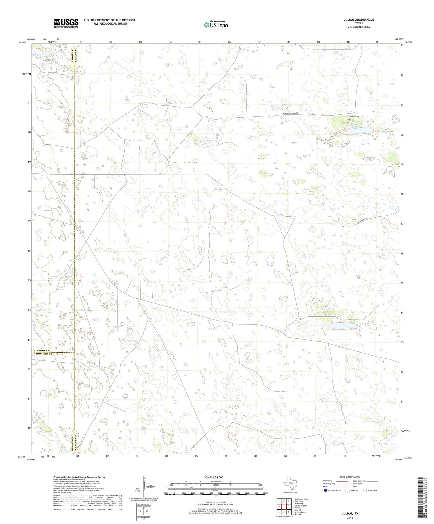
2022 topographic map quadrangle Julian in the state of Texas. Scale: 1:24000. Based on the newly updated USGS 7.5' US Topo map series, this map is in the following counties: Kenedy, Brooks, Hidalgo. The map contains contour data, water features, and other items you are used to seeing on USGS maps, but also has updated roads and other features. This is the next generation of topographic maps. Printed on high-quality waterproof paper with UV fade-resistant inks.
Quads adjacent to this one:
West: Callo Padrones
Northwest: San Tomas Camp
North: Pita Camp
Northeast: Armstrong
East: Norias
Southeast: Rudolph
South: Andrea Ranch
Southwest: Linn NE
This map covers the same area as the classic USGS quad with code o26097g8.
Contains the following named places: Alazan Artesian Well, Alto Bonito Windmill, Caesar Artesian Well, Candelaria Hill, Candelaria Lake, Chaparrosa Camp, Comanche Artesian Well, Coyote Artesian Well, Gallo Artesian Well, Julian, Julian Artesian Well, Rich Artesian Well, Samuel Artesian Well, Tio Hilario Windmill