MyTopo
Encino Texas US Topo Map
Couldn't load pickup availability
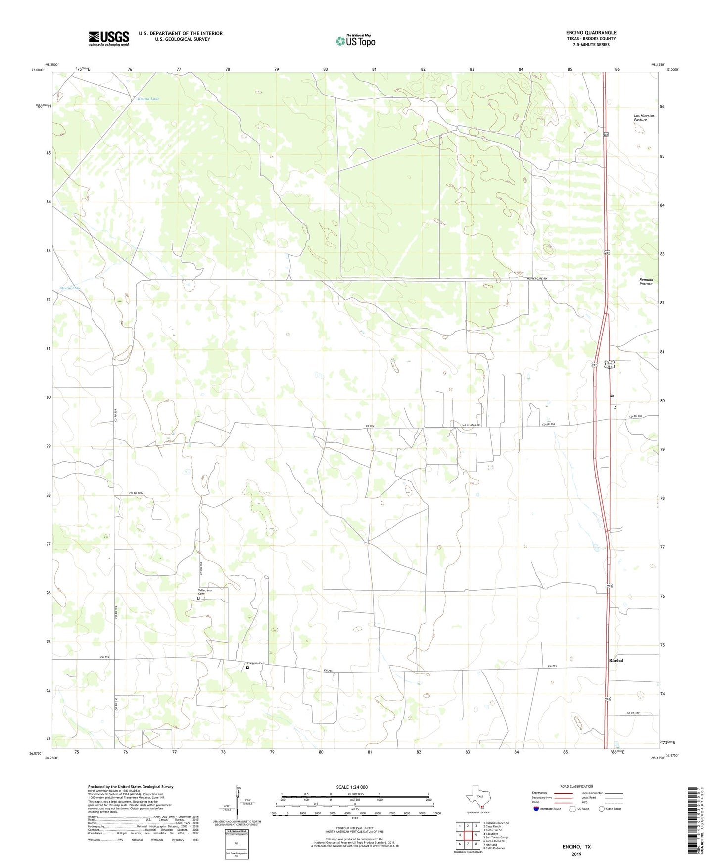
2022 topographic map quadrangle Encino in the state of Texas. Scale: 1:24000. Based on the newly updated USGS 7.5' US Topo map series, this map is in the following counties: Brooks. The map contains contour data, water features, and other items you are used to seeing on USGS maps, but also has updated roads and other features. This is the next generation of topographic maps. Printed on high-quality waterproof paper with UV fade-resistant inks.
Quads adjacent to this one:
West: Tacubaya
Northwest: Palomas Ranch SE
North: Cage Ranch
Northeast: Falfurrias SE
East: San Tomas Camp
Southeast: Callo Padrones
South: Hartland
Southwest: Santa Elena SE
This map covers the same area as the classic USGS quad with code o26098h2.
Contains the following named places: Agua Dulce Well, Alta Mesa East Oil Field, Alto Bonito Well, Benavides Family Cemetery, Benavidez Cemetery, Blanco Well, Cabas Lake, Chapeno Well, Chorro Well, Corner Well, Encino, Encino Division, Encino Post Office, Encino School, Enrique Villarreal Family Cemetery, Escondido Ranch, Heldeno Well, Jacobo Villarreal Family Cemetery, Juan Longoria Family Cemetery, Juan Well, La Dicha Well, La Mocha Well, La Parra Well, La Redonda Lake, La Venada Well, Las Hormigas Well, Llanito Well, Llano Well, Longoria Cemetery, Longorlliano Well, Los Compadres Well, Medio Lake, Medio Well, Narvaez Well, Nogales Well, Plano de Choche, Rachal, Rachal Oil Field, Rachal Siding, Ramirez Cemetery, Ramon Well, Round Lake, Ruben Trevino Family Cemetery, San Juan Well, San Mateo Cemetery, Sandia Well, Santa Rita Ranch Cemetery, Saul Trevino Cemetery, Servando Villarreal Family Cemetery, Skipper Ranch, Tepeguaje Ranch, Transito Villarreal Family Cemetery, Vallerreno Cemetery, Venado Well, Wheeler Well, ZIP Code: 78353