MyTopo
Linn NW Texas US Topo Map
Couldn't load pickup availability
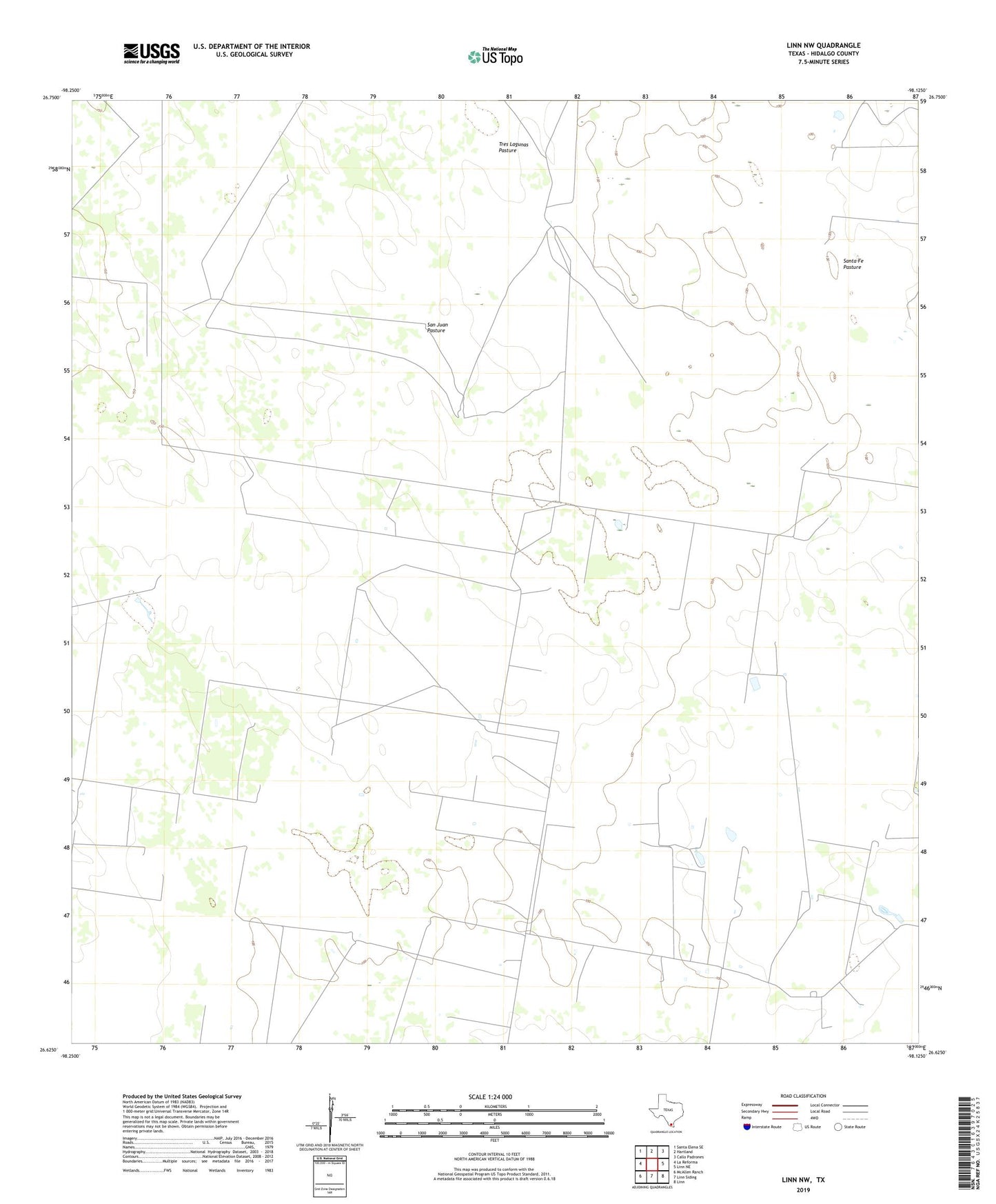
2022 topographic map quadrangle Linn NW in the state of Texas. Scale: 1:24000. Based on the newly updated USGS 7.5' US Topo map series, this map is in the following counties: Hidalgo. The map contains contour data, water features, and other items you are used to seeing on USGS maps, but also has updated roads and other features. This is the next generation of topographic maps. Printed on high-quality waterproof paper with UV fade-resistant inks.
Quads adjacent to this one:
West: La Reforma
Northwest: Santa Elena SE
North: Hartland
Northeast: Callo Padrones
East: Linn NE
Southeast: Linn
South: Linn Siding
Southwest: McAllen Ranch
This map covers the same area as the classic USGS quad with code o26098f2.
Contains the following named places: Agua Dulce Windmill, Beaurline Gas Field, Caliche Windmill, Comanche Windmill, Copita Well, Devisadores Windmill, El Neuvo Windmill, El Rancho Nuevo Windmill, El Rastrillo Windmill, El Rodeo Windmill, Hermanas Windmill, Hermanos Windmill, Leda Windmill, Los Indios Gas Field, Los Indios Ranch, Los Indios Windmill, Muertos Windmill, Mujeres Windmill, Noche Buena Windmill, Number Two Windmill, Pamorana Windmill, Potrero Windmill, San Juan Pasture, Santa Fe Ranch, Tres Lagunas Windmill