MyTopo
San Tomas Camp Texas US Topo Map
Couldn't load pickup availability
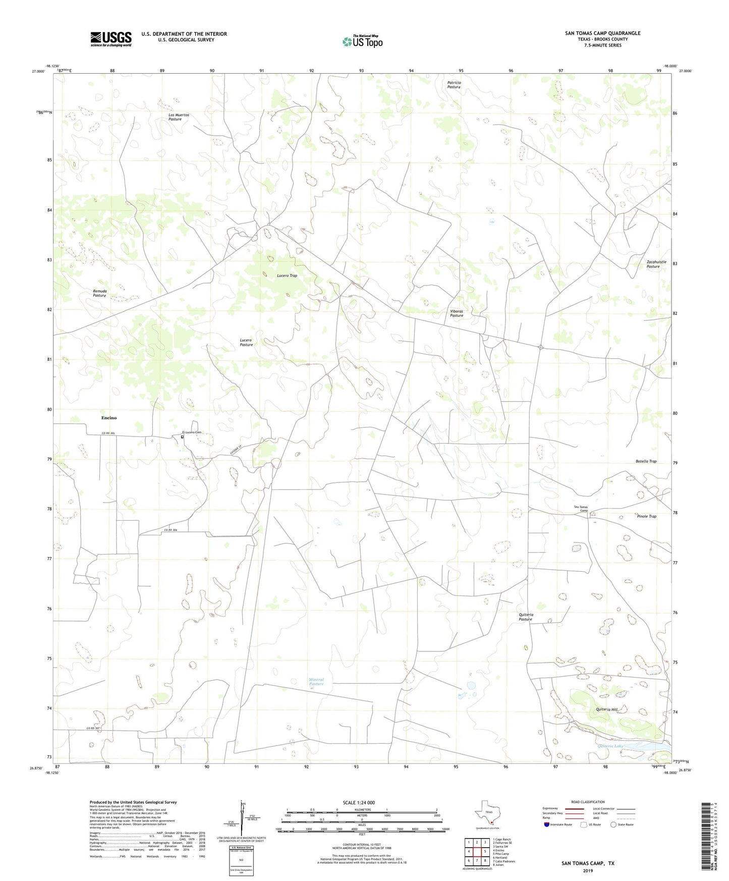
2022 topographic map quadrangle San Tomas Camp in the state of Texas. Scale: 1:24000. Based on the newly updated USGS 7.5' US Topo map series, this map is in the following counties: Brooks. The map contains contour data, water features, and other items you are used to seeing on USGS maps, but also has updated roads and other features. This is the next generation of topographic maps. Printed on high-quality waterproof paper with UV fade-resistant inks.
Quads adjacent to this one:
West: Encino
Northwest: Cage Ranch
North: Falfurrias SE
Northeast: Sarita SW
East: Pita Camp
Southeast: Julian
South: Callo Padrones
Southwest: Hartland
This map covers the same area as the classic USGS quad with code o26098h1.
Contains the following named places: Botella Trap, Cuervitos Windmill, El Cinco Windmill, El Dorado Windmill, El Lucero Cemetery, El Maromero Windmill, El Perdido Windmill, Encino Census Designated Place, Encino Ranch, Encino Viejo Windmill, Guerritas Windmill, La Blanca Windmill, La Loba Windmill, La Magada Windmill, La Presita Windmill, Laguna Salada, Las Flores Windmill, Leoncitas Windmill, Llave Windmill, Los Huesos Windmill, Los Tajos Windmill, Lucero Pasture, Lucero Trap, Lucero Windmill, Mineral Pasture, Morales Windmill, Mota del Tacon Windmill, Number Two Windmill, Piedra Windmill, Pinole Trap, Quiteria Hill, Quiteria Lake, Quiteria Windmill, Remuda Pasture, San Tomas Camp, Tacon Windmill, Trieste Windmill, Viboras Oil Field, Viboras Pasture, Viboras Windmill, Zacahuistle Pasture