MyTopo
Pita Camp Texas US Topo Map
Couldn't load pickup availability
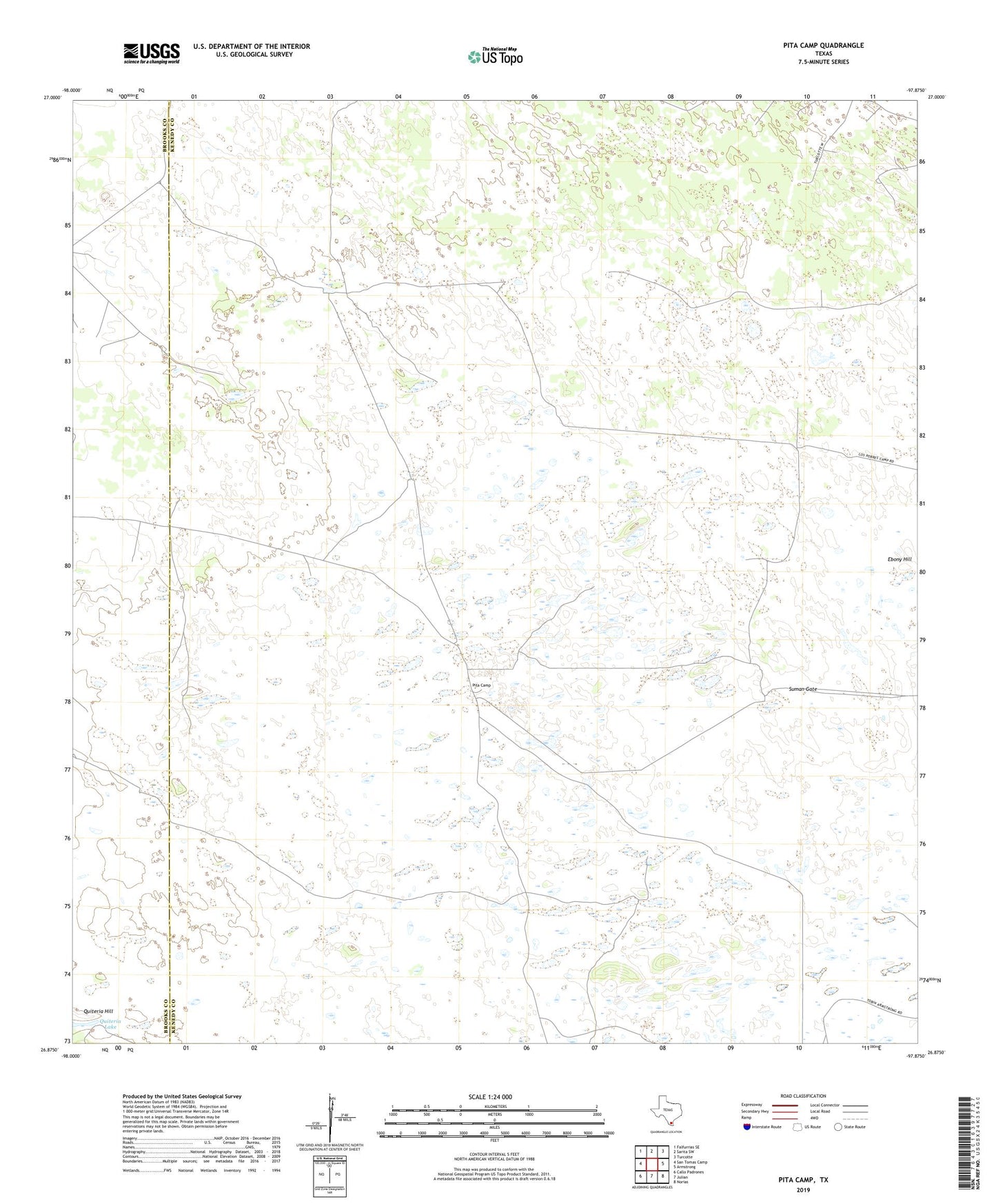
2022 topographic map quadrangle Pita Camp in the state of Texas. Scale: 1:24000. Based on the newly updated USGS 7.5' US Topo map series, this map is in the following counties: Kenedy, Brooks. The map contains contour data, water features, and other items you are used to seeing on USGS maps, but also has updated roads and other features. This is the next generation of topographic maps. Printed on high-quality waterproof paper with UV fade-resistant inks.
Quads adjacent to this one:
West: San Tomas Camp
Northwest: Falfurrias SE
North: Sarita SW
Northeast: Turcotte
East: Armstrong
Southeast: Norias
South: Julian
Southwest: Callo Padrones
This map covers the same area as the classic USGS quad with code o26097h8.
Contains the following named places: Ball Ranch, Cerrito Artesian Well, Ebony Hill, El Toro Artesian Well, Golondrina Windmill, Jim Windmill, Lindero Artesian Well, Llanito Windmill, Los Pobres Windmill, Number Four Windmill, Number Three Windmill, Patron Windmill, Pinole Lake, Pita Camp, Puerta Bajita Artesian Well, Rita Windmill, Senorita Artesian Well, Suman Gate, Zacahuistle Windmill