MyTopo
Camp Branch Texas US Topo Map
Couldn't load pickup availability
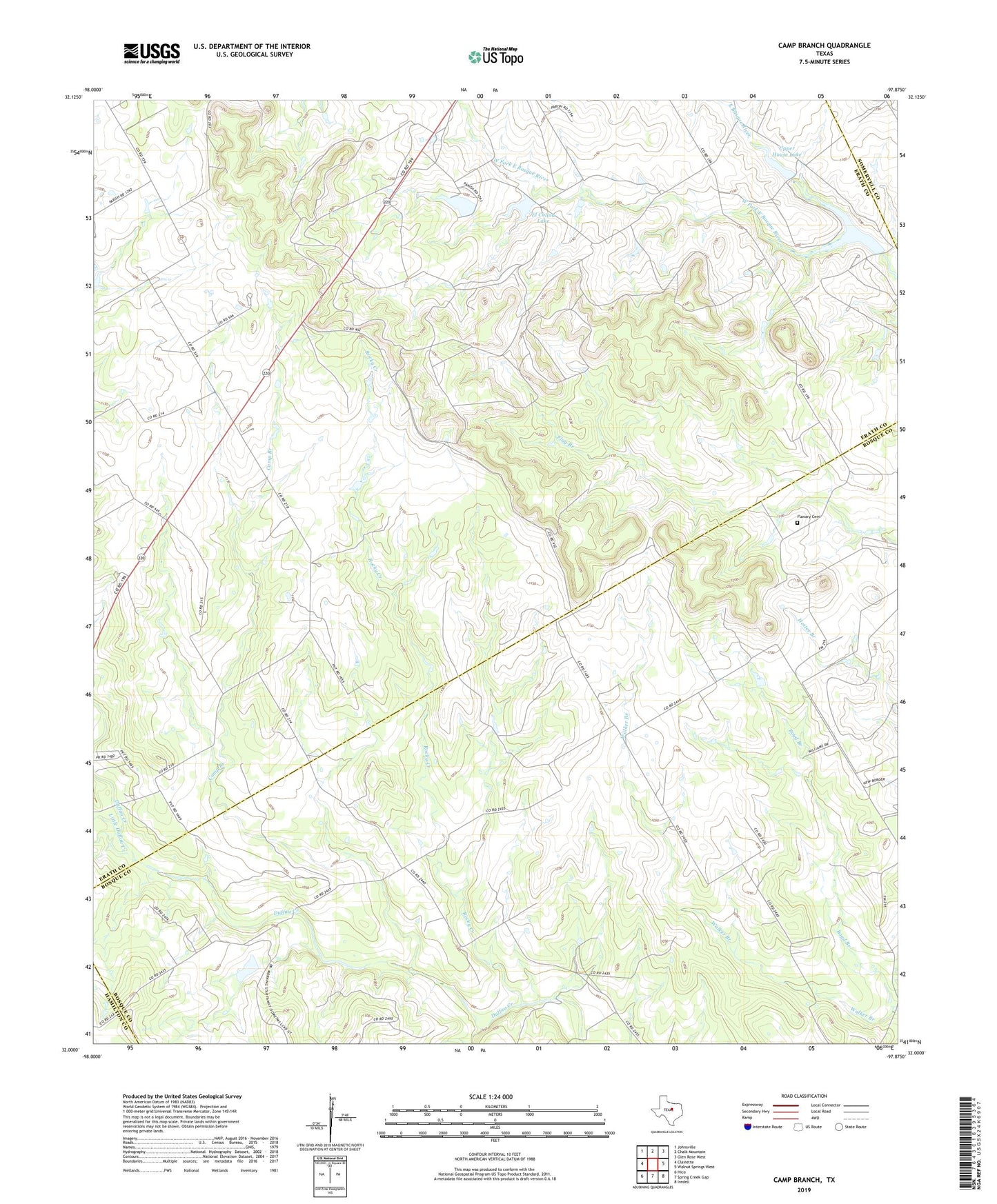
2019 topographic map quadrangle Camp Branch in the state of Texas. Scale: 1:24000. Based on the newly updated USGS 7.5' US Topo map series, this map is in the following counties: Erath, Bosque, Somervell, Hamilton. The map contains contour data, water features, and other items you are used to seeing on USGS maps, but also has updated roads and other features. This is the next generation of topographic maps. Printed on high-quality waterproof paper with UV fade-resistant inks.
Quads adjacent to this one:
West: Clairette
Northwest: Johnsville
North: Chalk Mountain
Northeast: Glen Rose West
East: Walnut Springs West
Southeast: Iredell
South: Spring Creek Gap
Southwest: Hico
Contains the following named places: Boyd Branch, Camp Branch, El Colina Lake, El Colina Lake Dam, Flanary Cemetery, Guadalupe County Public Library, House Lake, House Lake Dam, Little C Ranch Heliport, Little Duffau Creek, Rocky Creek, Surprise Valley Ranch, Upper House Lake, Upper House Lake Dam, West Fork East Bosque River, ZIP Code: 76649